
Paraguay occupies the geographic center of South America, defined less by mountains or coastlines than by rivers, plains, and inland continuity. As a landlocked country, its identity is shaped by movement along waterways and across lowland interiors rather than by external maritime exchange.
The Paraguay and Paraná rivers structure the nation’s physical and human geography. These rivers function as corridors for transport, settlement, agriculture, and cultural exchange, dividing the country into distinct eastern and western regions. Climate shifts from humid subtropical conditions in the east to semi-arid environments in the west, producing clear contrasts in land use and population density.
Paraguay’s development reflects adaptation to flat terrain and seasonal flooding. Agricultural systems, cattle ranching, and hydroelectric production dominate economic life, while cities remain moderate in scale and closely tied to river systems. Indigenous and mestizo cultures continue to shape land relationships, particularly in rural areas.
20. Asunción
Asunción is Paraguay’s capital and primary urban center, positioned along the eastern bank of the Paraguay River. Its location defines both its historical role and contemporary function as an inland port city oriented toward river-based movement rather than coastal exchange.
Founded in the sixteenth century, Asunción developed as a gateway into South America’s interior. River access allowed trade, migration, and administration to extend deep inland, shaping the city’s enduring role as a connector rather than a terminal.
The city’s topography consists of low hills descending toward flood-prone riverbanks. Seasonal water level changes influence urban planning, land use, and informal settlement patterns along the shoreline.
Asunción’s urban fabric blends colonial cores with modern expansion, spreading outward rather than upward. Heat, humidity, and limited elevation shape architecture and daily rhythm.
Economic life centers on government, services, and commerce tied to river logistics. Despite growth pressures, the city retains a relaxed scale compared to regional capitals.
Asunción represents Paraguay’s political and logistical heart, shaped by water access, interior orientation, and continuity over spectacle.
19. Paraguay River
The Paraguay River is the nation’s defining geographic feature, running north to south and structuring settlement, transportation, and ecology. As a major tributary of the Paraná, it links Paraguay to regional river networks reaching the Atlantic.
Its wide floodplain expands and contracts seasonally, creating wetlands, lagoons, and fertile alluvial soils. These dynamics support agriculture while imposing constraints on permanent infrastructure.
River transport remains vital, moving goods, fuel, and agricultural products. Ports and towns developed at navigable points, reinforcing linear settlement patterns.
Ecologically, the river sustains fisheries, wetlands, and biodiversity corridors. Human activity depends on balancing use with flooding cycles.
Culturally, the river functions as a shared space connecting communities rather than dividing them.
The Paraguay River represents the country’s central artery, where water governs movement, livelihood, and spatial logic.
18. Central Lowlands
Paraguay’s Central Lowlands form the country’s most densely populated and agriculturally productive zone. Flat terrain, fertile soils, and reliable rainfall support farming and settlement continuity.
Crop cultivation, livestock production, and agro-industry dominate land use. Fields extend broadly, interrupted by small towns and transport corridors rather than major urban concentrations.
The absence of significant elevation simplifies infrastructure development but increases vulnerability to flooding and heat.
Rural life remains closely tied to seasonal cycles and water availability. Smallholder farms coexist with larger agricultural operations.
The lowlands provide stability and food security for the nation.
They represent Paraguay’s interior core, defined by continuity, productivity, and understated scale.
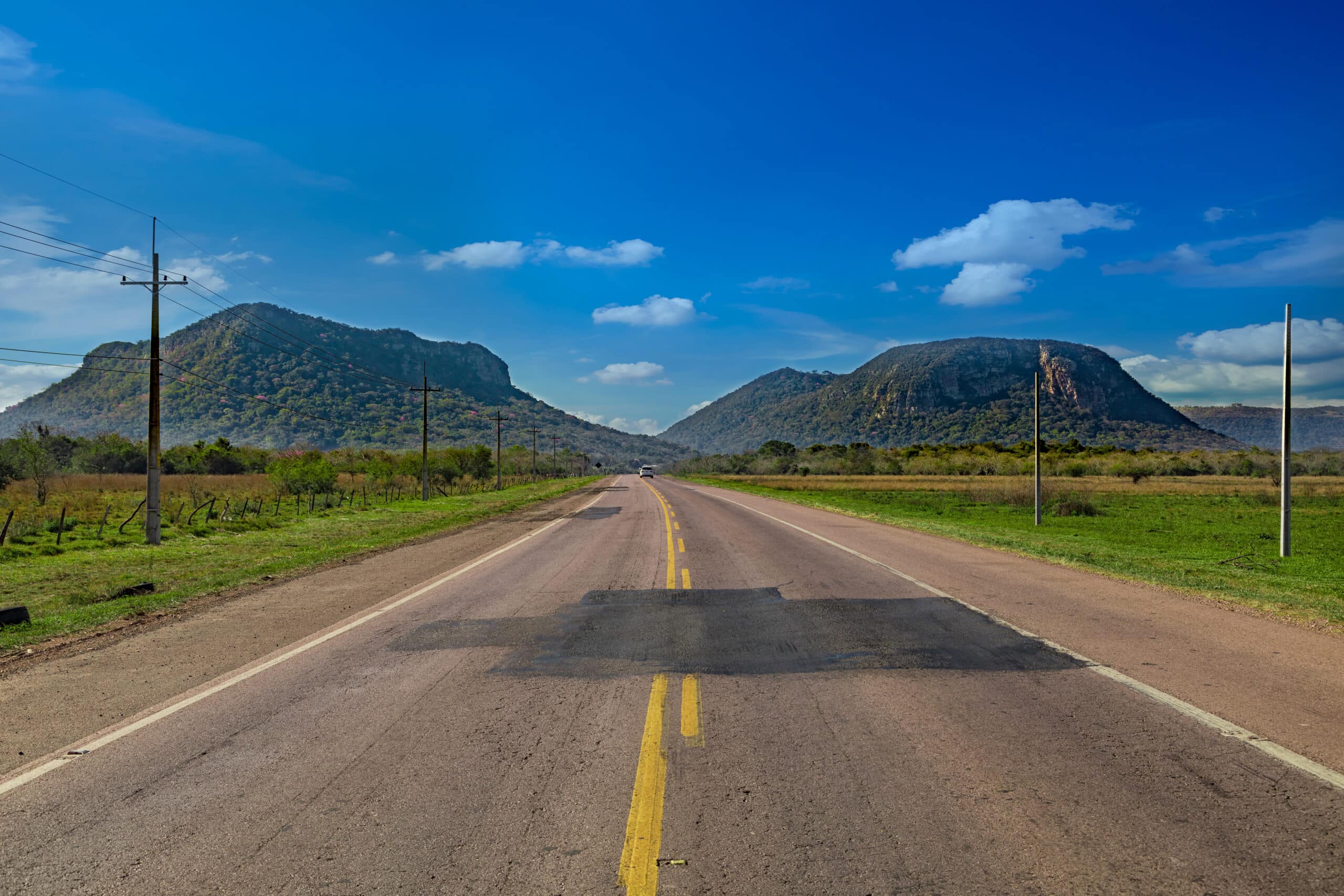
17. Cordillera de los Altos
The Cordillera de los Altos is a series of low hills rising gently from Paraguay’s central plains. Though modest in elevation, these uplands interrupt the country’s otherwise flat geography.
The hills influence local climate, drainage, and settlement placement. Streams originating here feed surrounding lowlands and support agriculture.
Historically, the cordillera provided defensible positions and cooler microclimates for towns and rural communities.
Land use includes farming, forestry, and small-scale settlement adapted to rolling terrain.
The cordillera introduces variation without dominance.
It represents Paraguay’s subtle topographic diversity, where elevation alters rhythm rather than redefining landscape.
16. Ypacaraí Lake
Ypacaraí Lake lies east of Asunción within the central region, forming one of Paraguay’s most significant freshwater bodies. Shallow and expansive, the lake reflects the country’s hydrological sensitivity.
Fed by multiple streams, Ypacaraí responds quickly to rainfall and runoff. Water quality and level fluctuations have long influenced surrounding communities.
Settlements along its shores developed for fishing, agriculture, and seasonal use. Urban expansion has increased environmental pressure.
The lake plays a role in regional identity and ecological balance.
Ypacaraí illustrates the challenges of water management in lowland Paraguay.
It represents the intersection of nature, settlement, and environmental responsibility.
15. Paraná River
The Paraná River forms Paraguay’s eastern boundary and functions as one of South America’s most powerful and economically significant waterways. Compared to the Paraguay River, the Paraná is faster, deeper, and more engineered, reflecting its role in large-scale energy production and international trade.
Flowing southward toward the Río de la Plata, the river connects Paraguay to global markets despite the country’s landlocked position. Ports, dams, and industrial zones cluster along its banks, particularly in the east.
The river’s hydrology supports hydroelectric generation, irrigation, and navigation, but also introduces ecological disruption. Shoreline modification and altered flow regimes affect fisheries and floodplain systems.
Settlement along the Paraná is denser than elsewhere in Paraguay, driven by economic opportunity and infrastructure investment. Urban centers align with crossings and energy nodes.
The Paraná River represents Paraguay’s external-facing corridor, where inland geography meets regional integration.
14. Itaipú Dam
The Itaipú Dam stands as one of the world’s largest hydroelectric facilities, spanning the Paraná River between Paraguay and Brazil. Its scale and output have fundamentally shaped Paraguay’s modern economy.
Constructed in the late twentieth century, the dam transformed a river landscape into a vast reservoir. Energy production from Itaipú supplies most of Paraguay’s electricity and generates significant export revenue.
The dam’s presence reoriented infrastructure, settlement, and political relationships. Roads, transmission lines, and urban growth followed its development.
Environmental consequences include altered ecosystems and displaced communities, illustrating trade-offs inherent in large-scale infrastructure.
Itaipú symbolizes Paraguay’s reliance on water and energy rather than industrial diversity.
It represents the country’s strategic leverage through geography and cooperation.
13. Ciudad del Este
Ciudad del Este occupies a strategic position at Paraguay’s eastern edge, adjacent to Brazil and Argentina. Its growth reflects border dynamics rather than traditional urban evolution.
The city functions as a commercial and transit hub, driven by cross-border trade, logistics, and informal economies. Movement defines daily life, with constant flows of goods and people.
Urban form is dense and utilitarian, shaped by commerce rather than civic planning. Infrastructure prioritizes access points, bridges, and transport corridors.
Despite economic intensity, the city lacks strong industrial foundations, reinforcing its dependence on regional exchange.
Ciudad del Este represents Paraguay’s border-driven urbanism, where geography accelerates movement over permanence.
12. Eastern Forest Region
Paraguay’s Eastern Forest Region once formed part of the vast Atlantic Forest system, characterized by dense vegetation, high biodiversity, and humid climate. Today, it stands as one of the country’s most altered landscapes.
Agricultural expansion, logging, and settlement have reduced forest cover significantly. Remaining fragments persist alongside farmland and urban areas.
Soils are fertile but vulnerable to erosion once forest cover is removed, increasing environmental risk.
Conservation efforts coexist with continued land-use pressure.
The region illustrates the tension between productivity and preservation.
It represents Paraguay’s most contested ecological zone.
11. Encarnación
Encarnación lies along the southern Paraná River, functioning as a regional connector between Paraguay and Argentina. Its riverfront position defines both economy and urban identity.
Historically shaped by trade and migration, the city developed as a transportation and commercial node. River crossings reinforce cross-border integration.
Recent urban redevelopment reshaped the waterfront, altering flood patterns and land use. Infrastructure improvements expanded civic space but changed ecological dynamics.
Encarnación’s climate is humid subtropical, supporting agriculture and dense settlement.
The city balances growth with river dependency.
Encarnación represents Paraguay’s southern gateway, where river systems anchor regional connection.
10. Ñeembucú Wetlands
The Ñeembucú Wetlands occupy a broad floodplain in southern Paraguay, shaped by the interaction of the Paraguay and Paraná river systems. Seasonal flooding defines both ecological function and human use, creating a landscape governed by water movement rather than fixed boundaries.
During periods of high water, large portions of the region transform into shallow lakes, marshes, and temporary channels. These cycles support rich biodiversity, including migratory birds, fish, and wetland vegetation adapted to prolonged inundation.
Human settlement remains sparse and dispersed, concentrated on slightly elevated ground. Agriculture and cattle ranching are carefully timed around flood cycles, reinforcing a rhythm of use rather than permanent transformation.
Transportation infrastructure is limited, with access often dependent on water levels. Isolation contributes to preservation but also restricts economic diversification.
The wetlands function as natural flood regulators, absorbing excess water from upstream systems.
Ñeembucú represents Paraguay’s amphibious landscape, where land and water remain in constant negotiation.
9. Chaco Boreal
The Chaco Boreal covers Paraguay’s vast western half, defined by flat terrain, extreme heat, and low population density. This region contrasts sharply with the wetter, more developed eastern portion of the country.
Rainfall is irregular and often insufficient, producing dry forests, thorn scrub, and saline soils. Water availability governs every aspect of settlement and land use.
Cattle ranching dominates economic activity, requiring large landholdings and extensive infrastructure for water storage. Roads are sparse and often unpaved, reinforcing isolation.
The Chaco’s remoteness shaped historical conflict and continues to influence national identity.
Environmental conditions limit urban growth and encourage adaptive strategies.
The Chaco Boreal represents Paraguay’s interior frontier, defined by scale, heat, and endurance.
8. Mennonite Colonies
Mennonite colonies in Paraguay’s Chaco represent a distinctive adaptation to one of South America’s harshest environments. Established in the twentieth century, these communities introduced organized agriculture into arid conditions.
Through collective planning, water management, and technological innovation, the colonies transformed dry forest into productive land. Dairy farming and crop cultivation became central economic activities.
Settlement patterns emphasize functionality, with grid layouts and centralized services. Social organization supports resilience in isolation.
Despite modernization, colonies remain closely tied to environmental limits.
Their presence reshaped the Chaco’s economic landscape.
Mennonite colonies illustrate Paraguay’s capacity for adaptation through cooperation and planning.
7. Pilcomayo River
The Pilcomayo River forms part of Paraguay’s western boundary, flowing unpredictably across the Chaco plain. Its shifting channels and heavy sediment load make it one of the region’s most unstable rivers.
Seasonal floods alter course and wetlands, reshaping borders and ecosystems. Settlements must adapt continually to changing water paths.
The river supports fishing and sustains wetlands critical for wildlife.
Engineering efforts to control flow have met limited success, highlighting natural dominance.
The Pilcomayo defines movement and uncertainty in the western interior.
It represents Paraguay’s dynamic boundary, shaped by constant change.
6. Defensores del Chaco
Defensores del Chaco National Park occupies a remote section of northwestern Paraguay, protecting dry forests and wildlife within the Chaco Boreal. The park preserves one of the country’s least disturbed ecosystems.
Extreme temperatures, limited water, and difficult access define the area. Wildlife adapted to aridity thrives in the absence of intensive human activity.
The park also holds historical significance related to territorial defense and conflict.
Conservation efforts face challenges from climate stress and limited resources.
Defensores del Chaco represents Paraguay’s commitment to preserving its most extreme landscapes.
It stands as a symbol of protection at the nation’s margins.
5. Fortín Boquerón Area
The Fortín Boquerón area lies deep within Paraguay’s Chaco Boreal and carries both geographic and historical weight. This remote zone is defined by flat terrain, extreme heat, sparse vegetation, and limited water availability.
The landscape is dominated by dry forests and thorn scrub, interrupted by seasonal wetlands that appear briefly during periods of rain. Access is difficult, reinforcing isolation and limiting permanent settlement.
Historically, Fortín Boquerón is associated with the Chaco War, where geography played a decisive role. Scarcity of water and distance between supply points shaped movement, conflict, and survival.
Today, the area remains lightly inhabited, used primarily for extensive cattle ranching and conservation. Infrastructure is minimal and adapted to harsh conditions.
The environment demands endurance and planning rather than expansion.
Fortín Boquerón represents Paraguay’s historical interior, where land, conflict, and scarcity intersect.
4. Mariscal Estigarribia
Mariscal Estigarribia is one of Paraguay’s most remote towns, located in the heart of the Chaco Boreal. Its position emphasizes distance from population centers and reinforces the challenges of inland settlement.
Extreme heat, limited rainfall, and flat terrain define the town’s environment. Daily life adapts to climatic stress through timing, construction methods, and water management.
The town serves as a logistical point for surrounding ranches and military infrastructure. Services remain basic, reflecting low population density.
Road connections link Mariscal Estigarribia to eastern Paraguay, though travel remains long and demanding.
The settlement illustrates persistence under constraint.
Mariscal Estigarribia represents Paraguay’s deepest inland habitation, shaped by distance and resilience.
3. Trans-Chaco Highway
The Trans-Chaco Highway is Paraguay’s primary east–west transportation artery, connecting the populated eastern region with the remote Chaco interior. Its construction altered national cohesion and access.
The road crosses flat, arid terrain, requiring careful planning to manage heat, flooding, and soil instability. Maintenance remains a constant challenge.
The highway supports cattle transport, supply delivery, and limited settlement growth along its route. It also reinforces state presence in sparsely populated areas.
Despite its importance, development remains restrained by environmental limits.
The highway represents infrastructure as survival rather than expansion.
It symbolizes Paraguay’s effort to bridge interior distance.
2. Upper Paraguay Basin
The Upper Paraguay Basin occupies the northern interior, forming part of a vast river system extending into Brazil and Bolivia. This basin includes wetlands, channels, and seasonally flooded plains.
Water movement governs ecology and human activity. Fishing, cattle grazing, and small-scale agriculture adapt to fluctuating conditions.
Settlements are sparse and often temporary, responding to water availability.
The basin contributes to flood regulation downstream, linking Paraguay’s interior to broader hydrological systems.
Its remoteness preserves ecological integrity.
The Upper Paraguay Basin represents Paraguay’s northern water landscape, where continuity extends beyond borders.
1. Triple Frontier Zone
The Triple Frontier Zone marks the convergence of Paraguay, Brazil, and Argentina at the meeting of the Paraná and Iguazú rivers. This region is defined by movement, borders, and constant exchange.
Rivers function simultaneously as connectors and boundaries. Bridges and ports intensify cross-border flows of goods, labor, and culture.
Economic activity centers on trade, logistics, and energy infrastructure, linked closely to nearby dams and urban centers.
The zone’s identity is regional rather than national, shaped by overlapping jurisdictions.
It illustrates globalization within an inland context.
The Triple Frontier represents Paraguay’s outward-facing threshold, where borders dissolve into circulation.