

Argentina unfolds across a vast latitudinal span, extending from subtropical forests near the Tropic of Capricorn to subantarctic landscapes at the southern edge of the Americas. This scale produces striking contrasts in climate, terrain, and culture, yet the country maintains a strong internal coherence shaped by geography, migration, and land use.
The nation’s defining axis is north–south. Rivers, plains, mountains, and coasts align along this orientation, structuring movement, agriculture, and settlement. The Andes form a continuous western spine, while the Atlantic coastline opens the east to trade and migration. Between these edges lie fertile plains, arid plateaus, wetlands, and forests, each supporting distinct ways of life.
Argentina’s landscapes are deeply tied to production. Agriculture, ranching, mining, and energy extraction have shaped regions more than dense urbanization, with cities often functioning as organizing nodes rather than dominant centers. Even major metropolitan areas retain strong connections to hinterlands.
Culturally, Argentina reflects layers of Indigenous presence, colonial administration, European migration, and modern nation-building. These influences are expressed not only in cities but in rural patterns, architecture, and land division.
22. Los Glaciares National Park
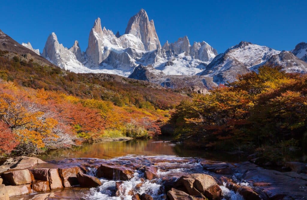
Los Glaciares National Park occupies the southern Andes of Argentina, spanning roughly 7,000 square kilometers in Santa Cruz Province. Its geography is defined by dramatic contrasts: rugged peaks, glacial icefields, turquoise lakes, and temperate Patagonian steppe. The Andes here act as a climatic divide, with moist Pacific winds rising over mountains to deposit snow that feeds extensive glaciers, while the eastern plains remain drier.

The park is dominated by the Southern Patagonian Ice Field, one of the world’s largest extrapolar ice masses. Glaciers such as Perito Moreno, Upsala, and Spegazzini carve deep valleys, deposit moraines, and feed downstream rivers and lakes. Seasonal meltwater shapes local hydrology, influencing both aquatic ecosystems and nearby human settlements. The dynamic motion of ice is visible across the landscape, where advancing or retreating tongues of ice alter shorelines and sediment distribution.
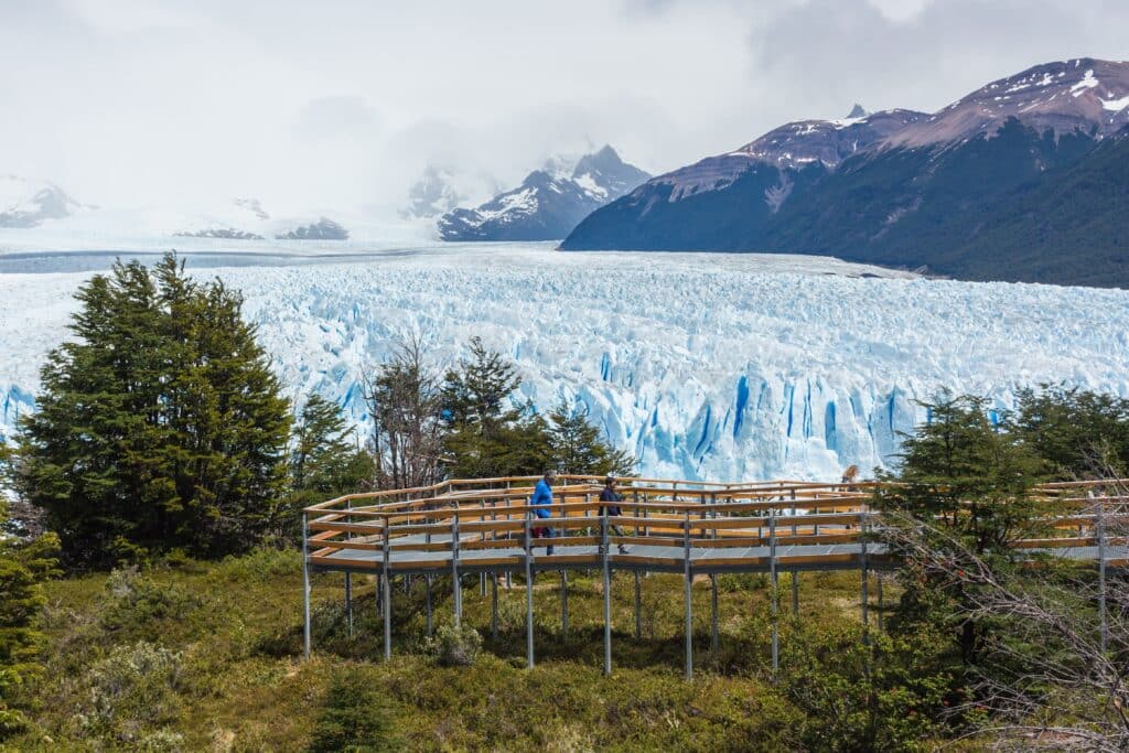
Access to the park is structured by geography. Trails, boardwalks, and boat routes concentrate visitors along safe corridors while protecting fragile glacial systems. The topography constrains infrastructure; steep relief, unstable moraine, and rapidly changing weather dictate careful planning for roads and settlements outside protected zones.
Flora and fauna reflect altitude and moisture gradients. Southern beech forests occupy lower valleys, giving way to shrub steppe and exposed rock nearer the ice. Guanacos, Andean condors, and native foxes traverse valleys, while freshwater lakes sustain trout and other cold-water species. Ecological balance hinges on seasonal shifts in temperature, precipitation, and glacial runoff.
Los Glaciares National Park represents Argentina’s southern extremity in both latitude and elevation, where ice and mountain dominate the landscape. Its significance derives not only from spectacular scenery but also from the dynamic processes of glaciation, hydrology, and ecological adaptation. Here, natural forces operate at scale, shaping the land and defining human interaction with one of South America’s most dramatic terrains.
21. Rosario

Rosario is one of Argentina’s most strategically positioned cities, located on the western bank of the Paraná River roughly midway between Buenos Aires and the country’s northern interior. Its geography, rather than political designation, defines its importance. Unlike the capital, Rosario emerged organically as a port city shaped by river commerce, agricultural exports, and inland connectivity.
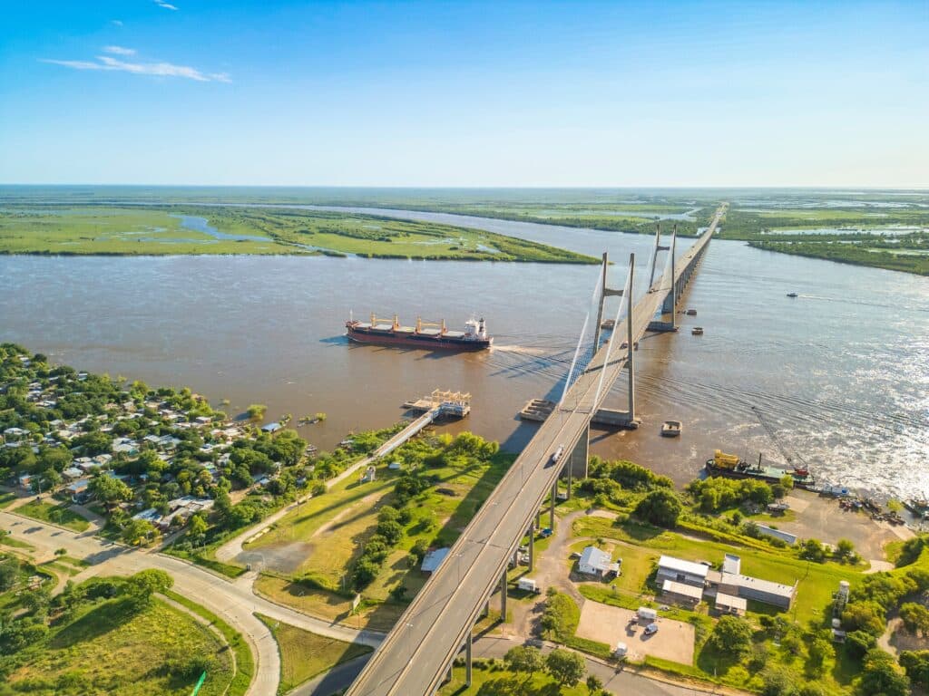
The Paraná River is central to Rosario’s identity. Broad, navigable, and constantly shifting, it provides access to international markets while anchoring the city within Argentina’s productive heartland. Grain terminals, docks, and logistics infrastructure line the riverfront, reflecting Rosario’s role as a key export node for soy, corn, and wheat from the surrounding Pampas. This relationship to the river has shaped both the economy and the city’s spatial orientation.
Rosario developed without the constraints of being a national capital, allowing a more flexible urban form. Its grid expands outward from the river, integrating residential neighborhoods, industrial zones, and green spaces. Public access to the waterfront has increased over time, transforming former port areas into civic and recreational corridors without erasing the city’s working identity.
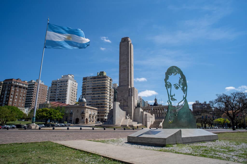
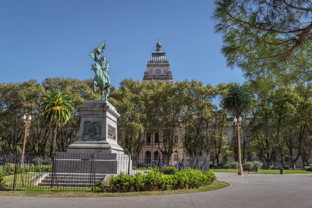
Culturally, Rosario functions as a regional counterweight to Buenos Aires. It supports strong academic institutions, cultural production, and political movements rooted in provincial identity. The city’s scale fosters intensity without overwhelming density.
Rosario represents Argentina’s inland urban strength: a city defined by movement of goods, river geography, and productive continuity rather than symbolic power.
20. Buenos Aires
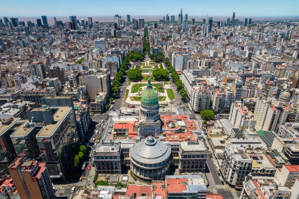
Buenos Aires anchors Argentina’s political, cultural, and economic life at the mouth of the Río de la Plata. Its position on a broad estuary rather than the open Atlantic shaped the city as a gateway between inland production and global exchange.

The city developed as a port serving the agricultural interior. Grain, meat, and raw materials flowed outward, while people, ideas, and capital flowed inward. This relationship between city and hinterland remains central to its identity.
Urban form reflects layered growth. Dense nineteenth-century cores, expansive residential neighborhoods, and modern districts coexist within a broad metropolitan footprint. Streets and avenues emphasize horizontality rather than vertical dominance.

Public space plays a defining role. Parks, plazas, cafés, and sidewalks function as extensions of domestic life, reinforcing civic engagement and social continuity.
Despite its scale, Buenos Aires retains a strong sense of neighborhood identity. Local rhythms persist alongside global influence.
Buenos Aires represents Argentina’s outward-facing capital, where geography, migration, and production converge at the edge of the continent.
19. Pampas Grasslands
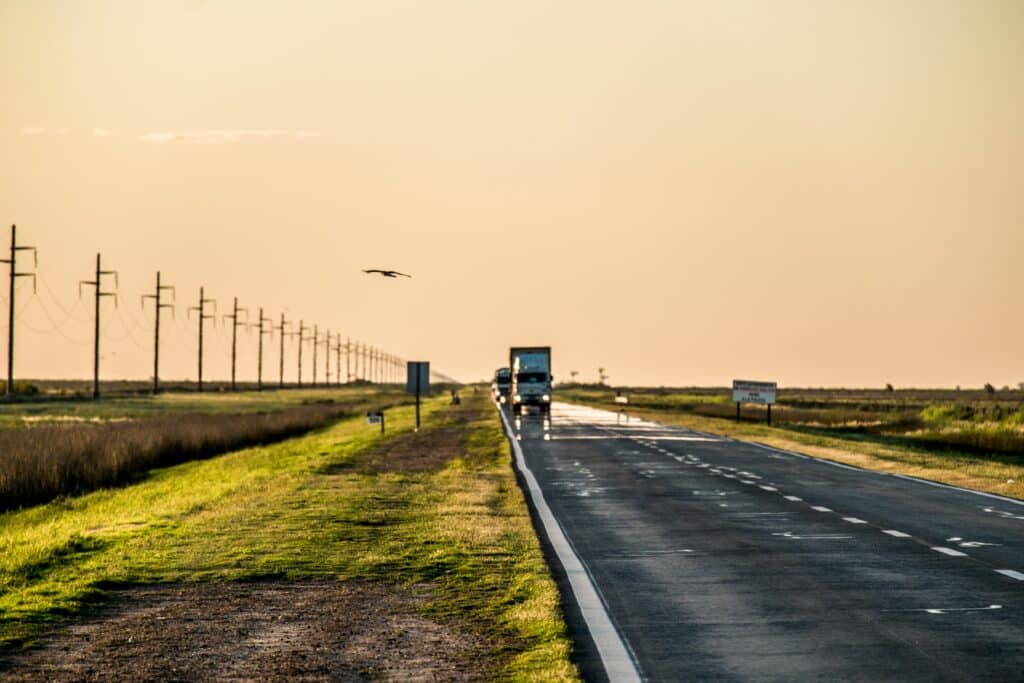
The Pampas grasslands form the agricultural heart of Argentina, stretching across vast flat plains defined by fertile soils and open horizons. This landscape shaped both the nation’s economy and its cultural mythology.
Naturally treeless and gently undulating, the Pampas support large-scale grain cultivation and cattle ranching. Their productivity transformed Argentina into a major global food producer.
Settlement patterns reflect agricultural efficiency. Estancias, silos, rail lines, and small towns are distributed to support production rather than density. Infrastructure emphasizes movement of goods over monumental architecture.
The openness of the Pampas shapes perception. Long distances, minimal elevation change, and expansive skies reinforce scale and continuity.
Culturally, the Pampas gave rise to rural traditions tied to horsemanship, land stewardship, and seasonal labor.
The Pampas represent Argentina’s productive core, where land use, identity, and economy remain inseparable.
18. Paraná River
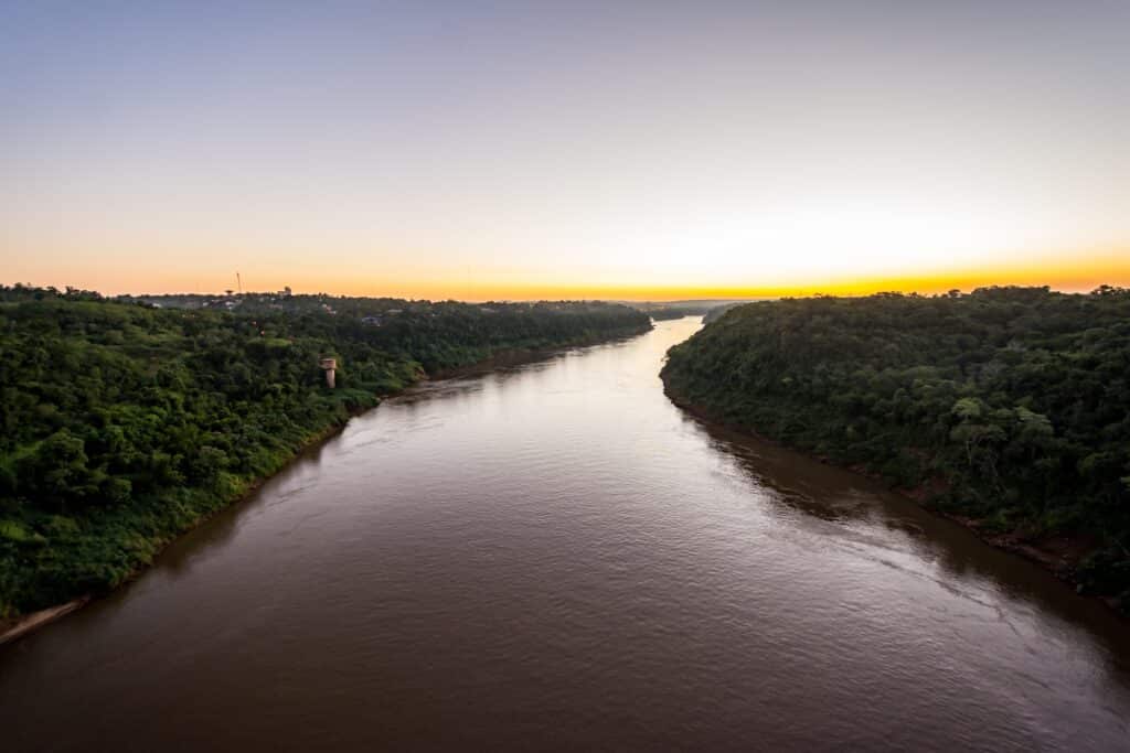
The Paraná River is one of South America’s great water systems, flowing southward through Argentina before merging with the Río de la Plata. Its scale and navigability make it central to trade, ecology, and settlement.
The river supports major ports and industrial centers while also sustaining wetlands, floodplains, and biodiversity-rich islands. Seasonal flooding renews soils and reshapes channels.

Cities along the Paraná developed as logistical nodes, linking agricultural production to international markets. River transport remains economically significant.
Ecologically, the river corridor functions as a continuous habitat supporting fish, birds, and plant communities.
The Paraná illustrates Argentina’s dependence on inland waterways as both economic engines and living systems.
17. Iguazú Falls
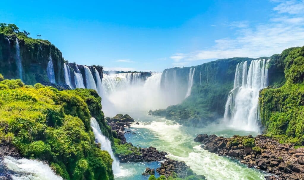
Iguazú Falls marks Argentina’s northeastern frontier, where the Iguazú River plunges over a series of basalt cliffs within dense subtropical forest. The falls express the power of water within a humid, biologically rich environment.

Unlike single-drop waterfalls, Iguazú consists of hundreds of cascades spread across a broad front. This fragmentation amplifies scale and sound, creating constant motion.
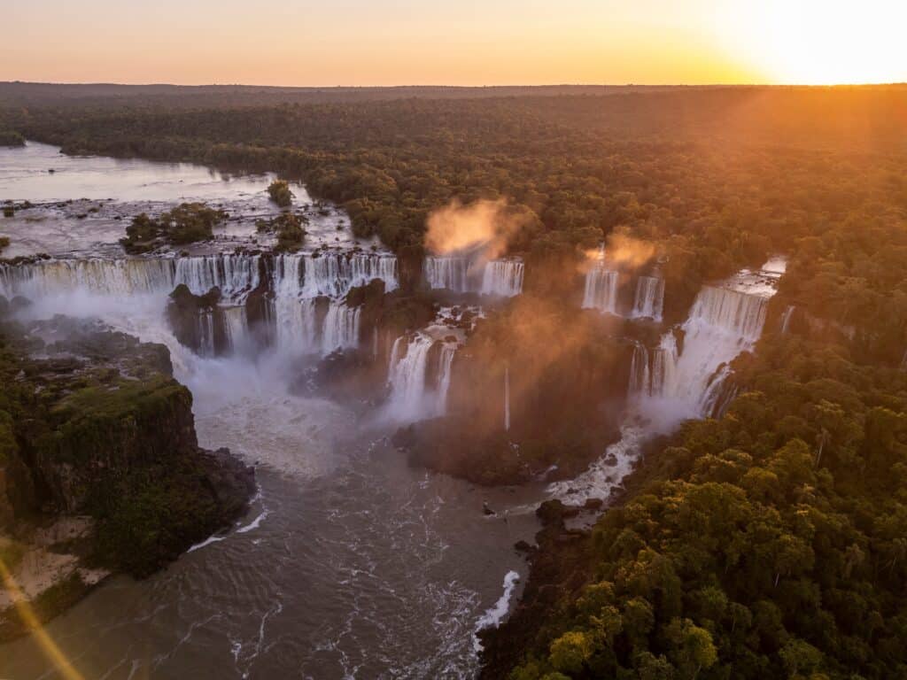
The surrounding forest regulates water flow, stabilizes soil, and supports extraordinary biodiversity. The falls and forest function as an integrated system.
Human presence is carefully managed to protect ecological processes while allowing access.
Iguazú Falls represent Argentina’s tropical extreme, where water and forest dominate landscape character.
16. Misiones Rainforest
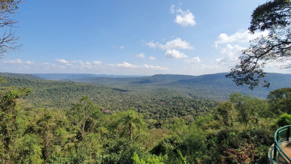
The Misiones Rainforest covers Argentina’s northeastern corner, defined by red lateritic soils, dense canopy, and high rainfall. It forms part of the larger Atlantic Forest ecosystem.
The forest’s structure is layered, with thick understory, towering trees, and limited visibility. Movement follows rivers and clearings rather than grids.

Agriculture and settlement exist in tension with conservation. Yerba mate cultivation and small-scale farming occupy cleared areas, while protected reserves preserve core habitats.
Borders with Paraguay and Brazil reinforce Misiones as a cultural and ecological borderland.
The Misiones Rainforest represents Argentina’s humid frontier, where biodiversity and land use remain in constant negotiation.
15. Córdoba

Córdoba occupies a strategic inland position at the geographic center of Argentina, functioning historically as a hinge between the Pampas, the Andes, and northern regions. Its location shaped the city as an administrative, educational, and transportation hub rather than a port.

Founded during the colonial period, Córdoba developed around religious institutions and governance. Universities, churches, and civic buildings established an intellectual and cultural foundation that continues to define the city.

The surrounding landscape introduces modest elevation changes, with rivers and foothills interrupting the plains. These features influenced urban form, water supply, and early industry.
Córdoba’s growth has remained relatively balanced. Dense historic areas coexist with expansive residential neighborhoods and industrial zones, maintaining human scale despite population size.
Its inland position fosters strong regional connections, linking agricultural production, manufacturing, and services.
Córdoba represents Argentina’s interior capital, where geography supports continuity, education, and regional integration.
14. Sierras de Córdoba
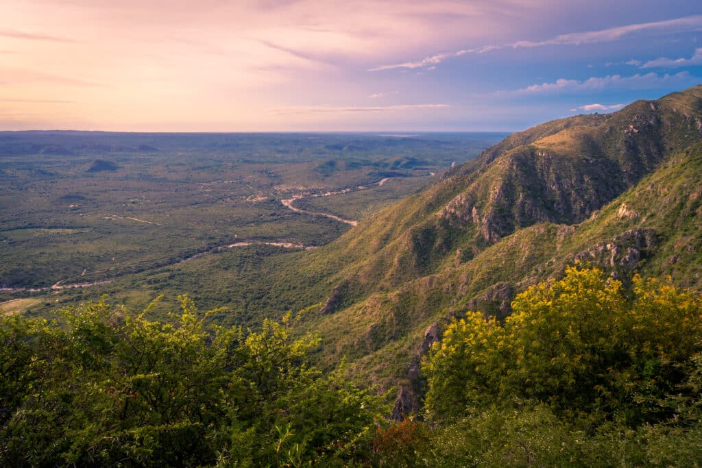
The Sierras de Córdoba rise abruptly from the surrounding plains, forming a system of low mountain ranges and valleys that disrupt Argentina’s central flatlands. These uplands create distinct microclimates and settlement patterns.
Streams descend from the sierras toward the plains, providing water sources that supported early villages and agriculture. Valleys offered refuge from heat and wind, encouraging seasonal movement and tourism.
Vegetation shifts with elevation, transitioning from grasslands to scrub and woodland. This diversity supports pastoralism and small-scale farming rather than intensive agriculture.
Towns developed along routes through the ranges, following natural corridors rather than imposed grids.
The sierras introduce relief and variation into Argentina’s interior.
They represent a geographic pause between plains and mountains, shaping regional identity through terrain.
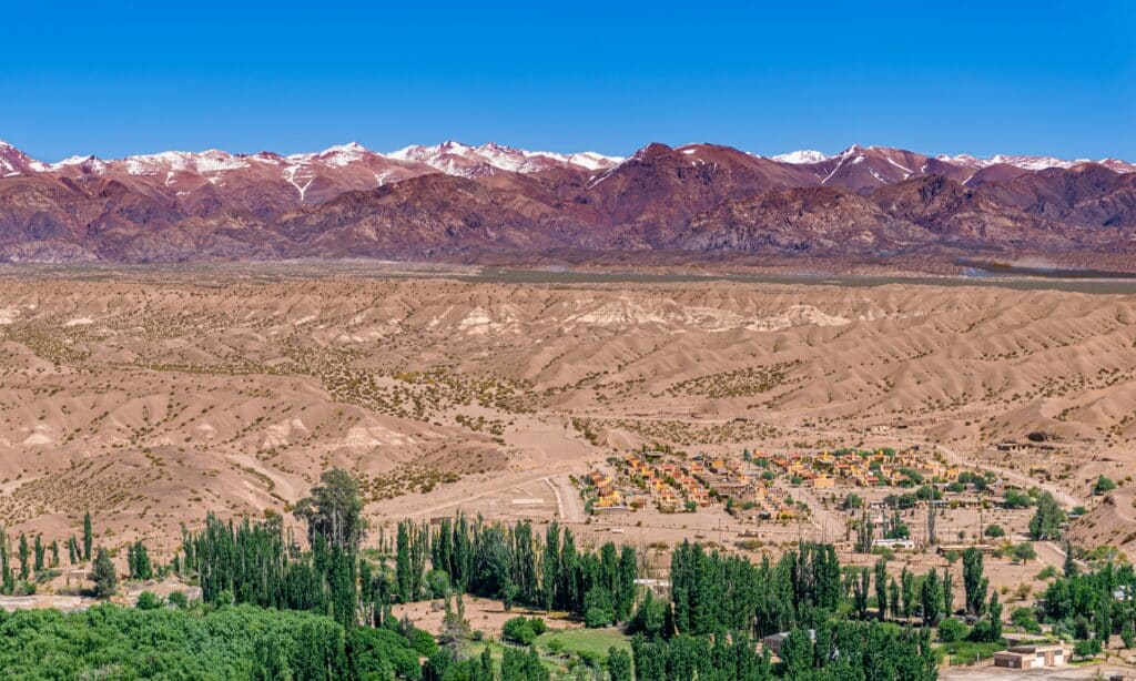
13. Mendoza

Mendoza lies at the eastern foothills of the Andes, where arid conditions dominate and water availability determines settlement. The city and surrounding region exist through extensive irrigation systems fed by Andean snowmelt.

Canals distribute water across vineyards and urban areas, transforming desert into productive land. Viticulture defines the region’s economy and landscape, aligning agriculture with climate and elevation.
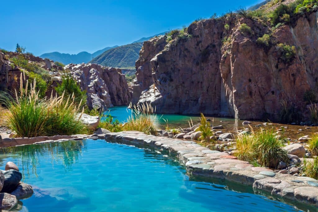
Urban form reflects seismic adaptation. Low-rise construction and wide streets reduce earthquake risk while creating openness.

The Andes loom immediately to the west, shaping climate, water supply, and cultural orientation.
Mendoza functions as a gateway between Argentina and the Pacific world through mountain passes.
It represents Argentina’s irrigated frontier, where human systems depend directly on mountain hydrology.
12. Aconcagua Region
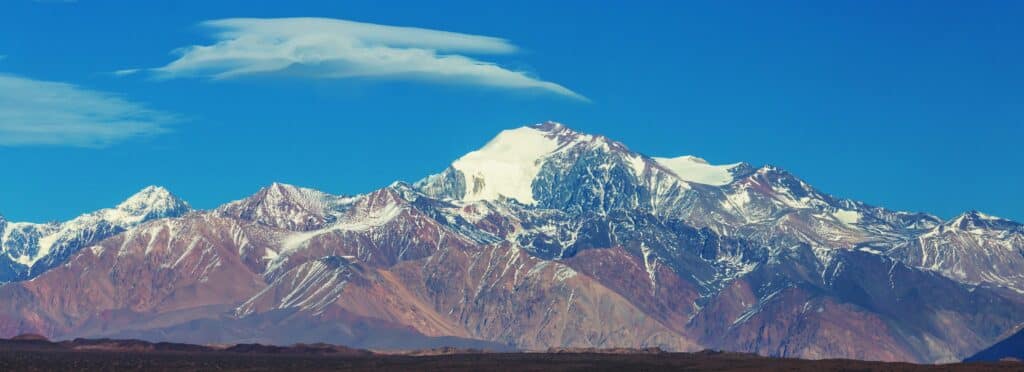
The Aconcagua region encompasses Argentina’s highest Andean terrain, defined by extreme elevation, thin air, and stark landscapes. Mount Aconcagua dominates as the highest peak in the Western Hemisphere.
Climate conditions are severe. Cold temperatures, strong winds, and limited precipitation restrict vegetation and settlement. Human presence is temporary and highly specialized.

Glaciers and snowfields feed downstream rivers, making the region hydrologically significant despite its apparent barrenness.
Routes through the Andes here have long connected Argentina to Chile, reinforcing the region’s strategic importance.
The landscape emphasizes verticality and exposure.
The Aconcagua region represents Argentina’s high-altitude extreme, where scale and geology overpower human influence.
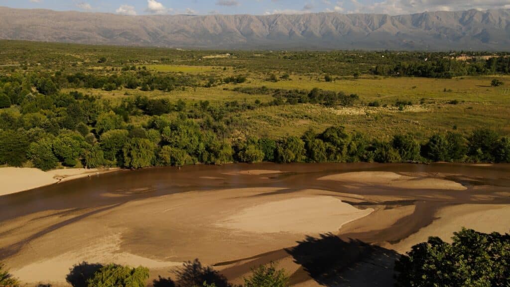
11. San Juan Desert
The San Juan Desert occupies arid valleys and basins along Argentina’s western interior, shaped by minimal rainfall and intense solar exposure. Water scarcity defines every aspect of settlement and land use.
Rivers descending from the Andes enable pockets of cultivation through irrigation. Outside these corridors, the landscape remains largely undeveloped.

Mining and energy extraction play significant roles, supported by the region’s geology.
Towns cluster tightly around water sources, emphasizing efficiency and adaptation.
The desert’s colors and openness reinforce a sense of isolation and resilience.
The San Juan Desert represents Argentina’s arid interior, where survival depends on precise management of scarce resources.
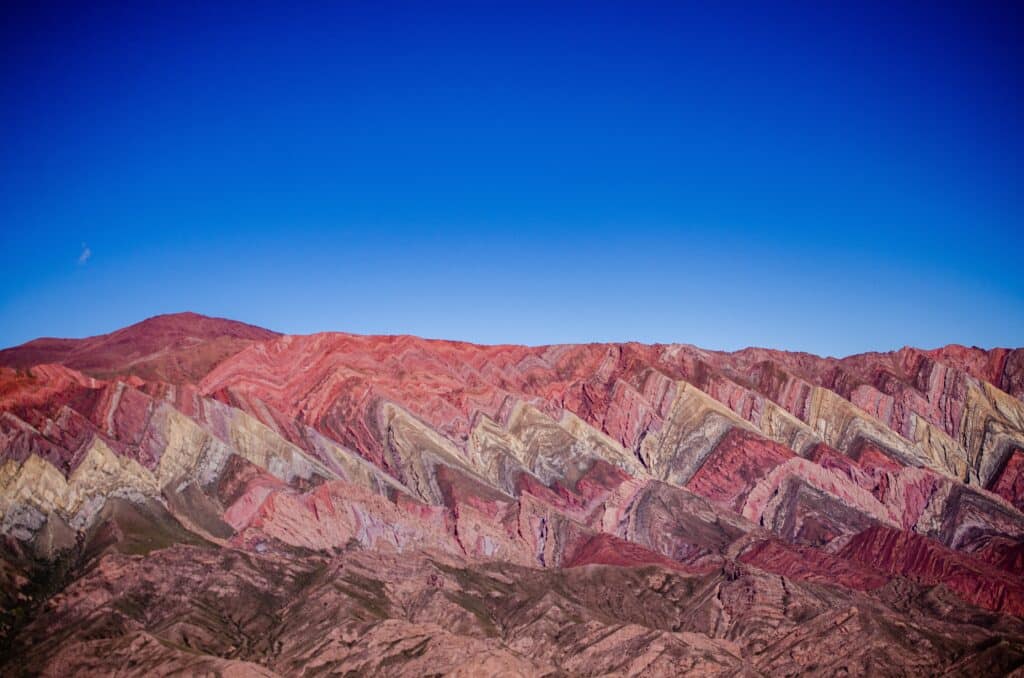
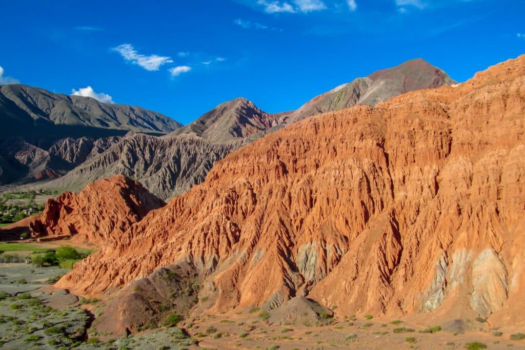
10. Quebrada de Humahuaca
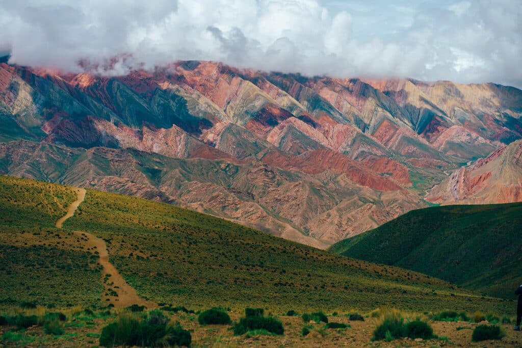
The Quebrada de Humahuaca is a narrow Andean corridor in northern Argentina that has structured movement, settlement, and exchange for thousands of years. Running north–south between high plateaus and mountain ranges, it functions as both a geographic passage and a cultural archive.
The valley’s geology is striking. Layered rock formations display bands of red, ochre, green, and gray, revealing deep geological time. These colors shift with light and season, reinforcing the valley’s visual intensity.
Historically, the quebrada served as a trade and migration route linking the Andean highlands with lower valleys. Indigenous communities established terraced agriculture and settlements adapted to altitude and aridity.
Spanish colonial infrastructure followed existing routes, embedding new towns within ancient patterns rather than replacing them.
Today, villages remain compact, oriented toward the valley floor and water sources. Agriculture continues on a small scale, shaped by elevation and climate.
The Quebrada de Humahuaca represents Argentina’s northern corridor, where geography preserves continuity across centuries of movement.
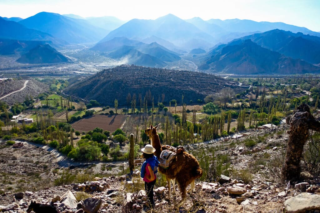
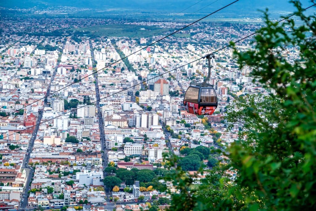
9. Salta
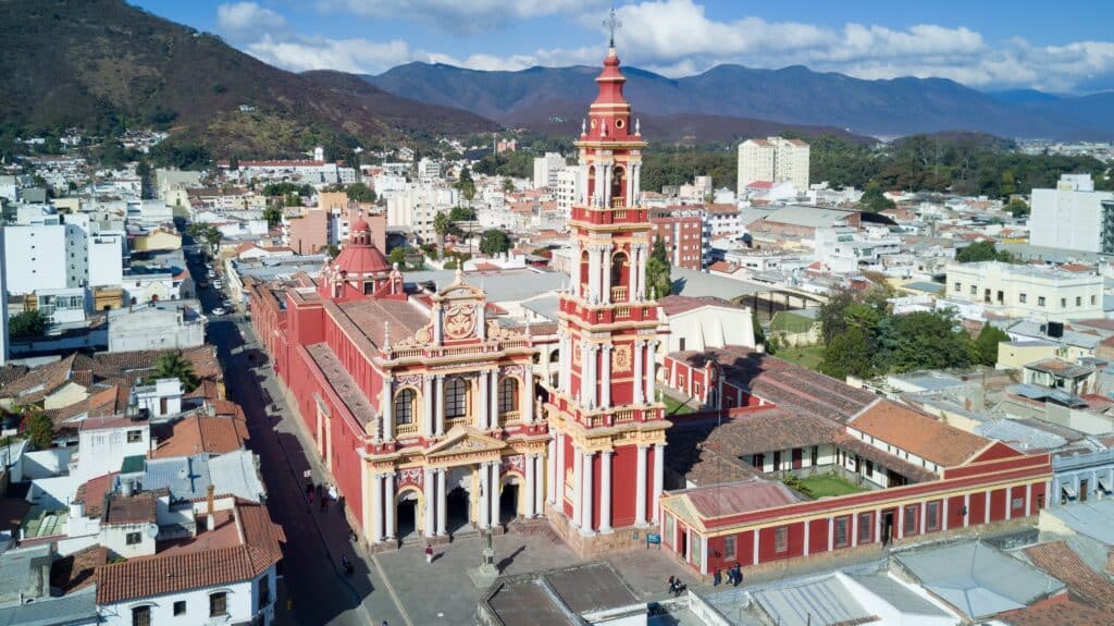
Salta sits within the Andean foothills of northwestern Argentina, positioned between high-altitude plateaus and lower subtropical valleys. Its location has long made it a regional administrative and cultural center.

The city’s colonial grid reflects Spanish planning adapted to uneven terrain. Central plazas, arcaded streets, and civic buildings anchor urban life.
Surrounding mountains shape climate and water flow, moderating temperatures and supporting agriculture in nearby valleys.
Salta functions as a gateway between ecological zones, linking Andean highlands with forested lowlands.
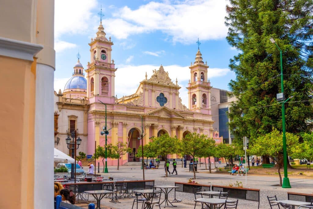
Despite growth, the city maintains strong ties to regional traditions, expressed through architecture, markets, and festivals.
Salta represents Argentina’s northern urban anchor, where history and geography converge.
8. Chaco Lowlands

The Chaco Lowlands extend across northern Argentina as a vast subtropical plain characterized by heat, seasonal rainfall, and thorny forest vegetation. This region contrasts sharply with both the Andes and the Pampas.

Soils and climate limit intensive agriculture, favoring livestock, forestry, and adapted crops. Clearing and cultivation have altered large areas, while remaining forests preserve biodiversity.
Rivers and wetlands appear intermittently, shaping settlement patterns tied to water availability.
Indigenous communities historically adapted to the region’s variability through mobility and local knowledge.
The Chaco remains one of Argentina’s least densely populated regions, defined by distance and environmental constraint.
It represents Argentina’s subtropical interior, where land use balances productivity and limitation.
7. Esteros del Iberá

The Esteros del Iberá form one of South America’s largest wetland systems, covering vast low-lying areas of northeastern Argentina. Shallow lakes, marshes, and floating vegetation define a landscape governed by slow-moving water.
Hydrology determines every aspect of the region. Seasonal flooding reshapes channels and habitats, sustaining high biodiversity.

Historically, the wetlands limited settlement and large-scale agriculture, preserving ecological integrity.
Recent conservation efforts emphasize restoration and sustainable livelihoods, including wildlife management.
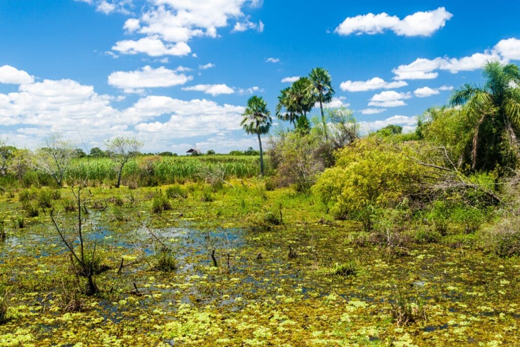
The landscape feels open yet enclosed by water, with subtle elevation changes shaping movement.
The Esteros del Iberá represent Argentina’s wetland heart, where water defines both opportunity and restraint.
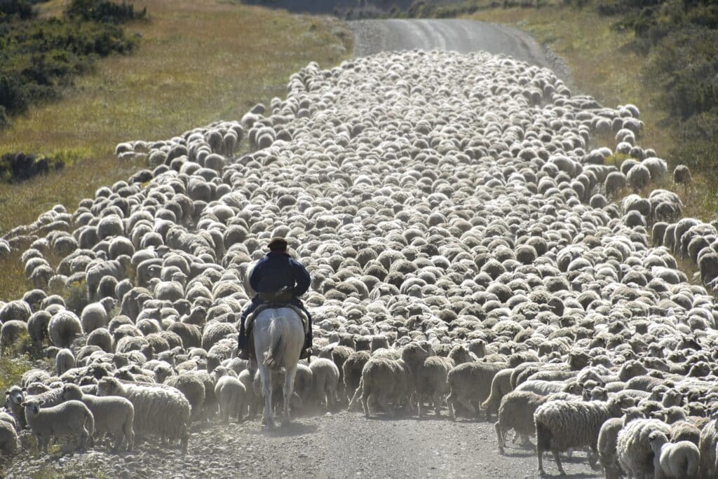
6. Patagonia Steppe

The Patagonia Steppe stretches across southern Argentina as an expansive, windswept plateau defined by aridity and distance. Sparse vegetation, gravel plains, and low shrubs dominate the landscape.
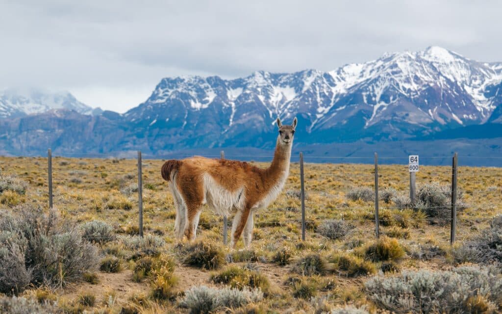
Strong winds and low rainfall limit agriculture, favoring extensive sheep ranching and low-density settlement.
Infrastructure follows necessity rather than density. Roads, fences, and isolated buildings emphasize scale and isolation.

The steppe creates a transitional zone between the Andes and the Atlantic coast.
Its openness shapes perception, reinforcing endurance and horizontal immensity.
The Patagonia Steppe represents Argentina’s southern interior, where scale and climate outweigh human presence.
5. Bariloche
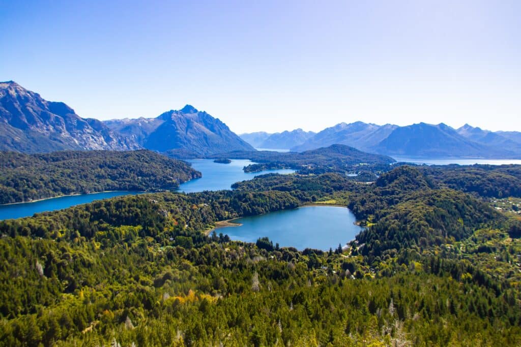
Bariloche lies in Argentina’s northern Patagonian Andes, set among glacial lakes, forested slopes, and snow-capped peaks. Its landscape contrasts sharply with the surrounding steppe, introducing vertical relief and abundant freshwater.

The city developed as a regional hub tied to transportation, forestry, and later tourism. Its location near Andean passes and lake systems made it a natural center of movement and settlement.
Lakes such as Nahuel Huapi structure both ecology and urban form. Shorelines, peninsulas, and islands create complex spatial relationships between water and land.
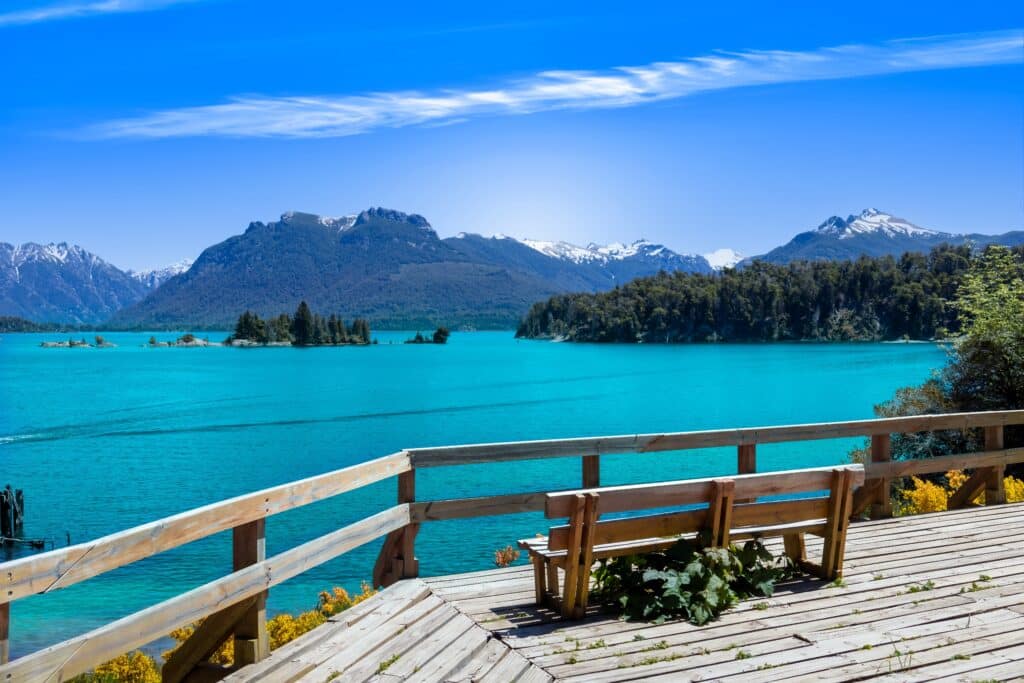
Forests of lenga and cypress dominate surrounding hills, supporting biodiversity and moderating climate.
Bariloche’s architecture reflects adaptation to mountain conditions, with low-rise buildings and materials suited to snow and cold.
The city balances human presence with protected landscapes.
Bariloche represents Argentina’s alpine south, where water, forest, and elevation redefine Patagonian identity.
4. Valdés Peninsula

The Valdés Peninsula extends into the Atlantic Ocean along Argentina’s Patagonian coast, defined by arid land, strong winds, and rich marine ecosystems. Its isolation has preserved both terrestrial and oceanic environments.

Surrounding waters support diverse marine life, sustained by nutrient-rich currents. Coastal geometry creates sheltered bays that function as breeding and feeding grounds.
On land, vegetation is sparse, shaped by wind and limited rainfall. Human settlement remains minimal, focused on research, conservation, and small-scale ranching.
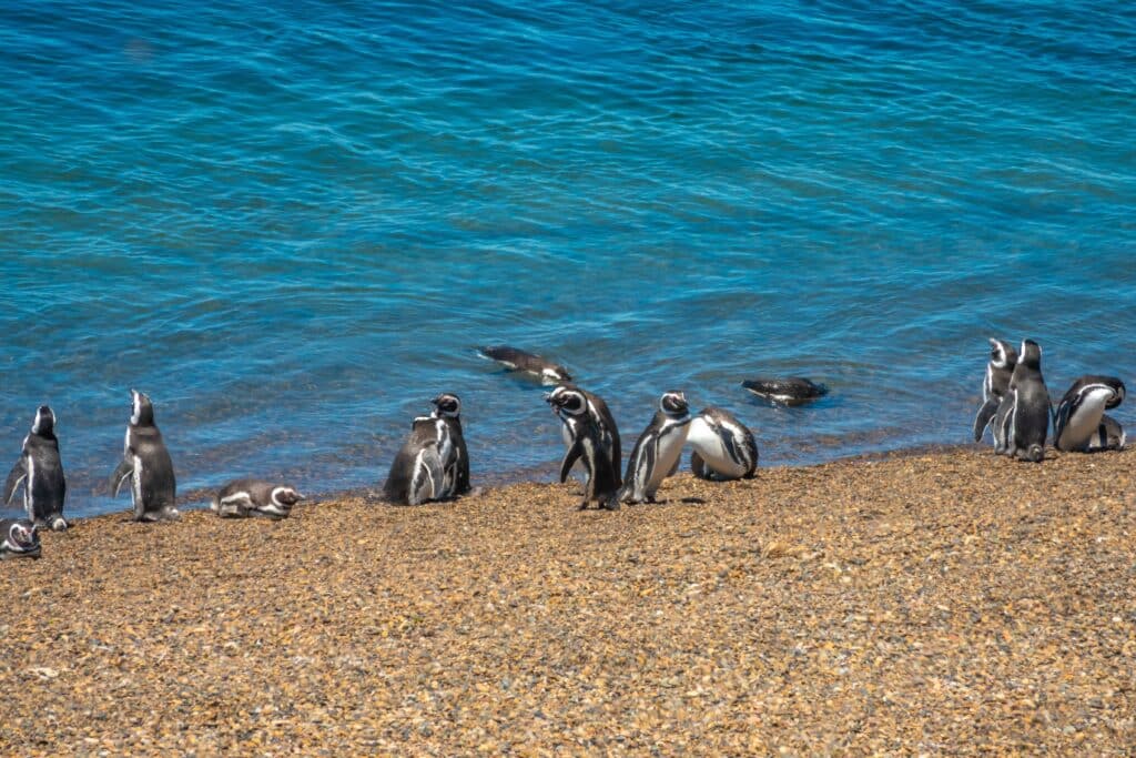
Infrastructure is sparse and purposeful, reinforcing the peninsula’s remoteness.
The meeting of desert land and productive sea defines the region’s character.
Valdés Peninsula represents Argentina’s marine frontier, where conservation and exposure shape coastal identity.
3. Tierra del Fuego
Tierra del Fuego marks the southernmost extension of Argentina, defined by rugged mountains, dense subantarctic forests, and cold maritime climate. The archipelago’s geography emphasizes separation and edge conditions.

Glacial valleys, peat bogs, and fjords structure the landscape. Weather patterns are unpredictable, shaped by Southern Ocean systems.
Human settlement developed late and remains sparse, constrained by climate and terrain.

Forests of lenga and southern beech dominate protected areas, supporting unique ecosystems.
The region’s isolation reinforces self-reliance and adaptation.
Tierra del Fuego represents Argentina’s southern threshold, where land meets polar influence.
2. Ushuaia

Ushuaia sits on the southern coast of Tierra del Fuego, framed by mountains and the Beagle Channel. Its position makes it the world’s southernmost city and a symbol of geographic extremity.
Originally established as a penal colony, Ushuaia evolved into a port supporting navigation, fishing, and logistics. Isolation shaped its infrastructure and community life.

The city’s layout follows the narrow coastal plain, constrained by steep slopes and water.
Harsh climate influences building design, transportation, and daily rhythm.

Despite its remoteness, Ushuaia functions as a gateway to southern seas and Antarctica.
Ushuaia represents Argentina’s edge settlement, defined by constraint, endurance, and orientation toward the unknown.
1. Atlantic Coast of Buenos Aires Province
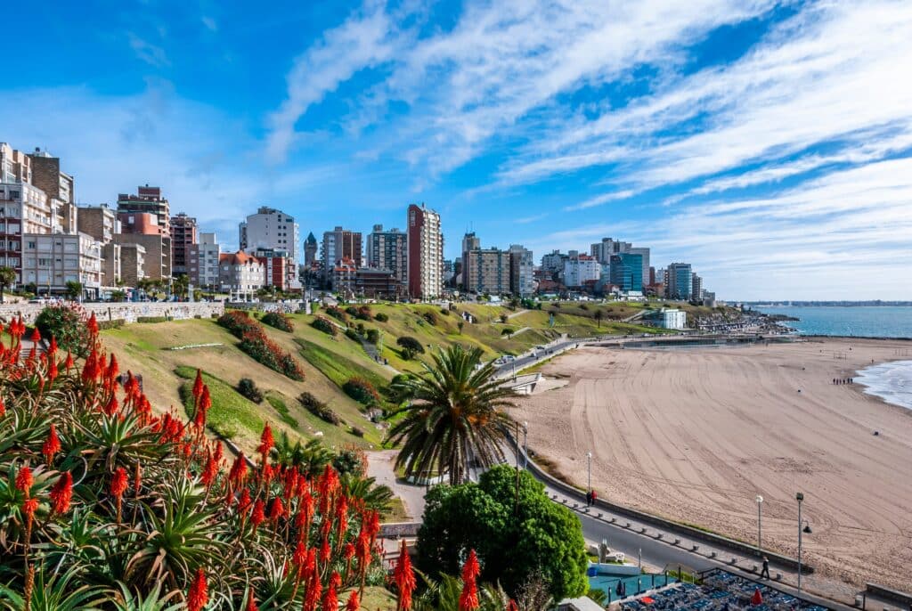
The Atlantic Coast of Buenos Aires Province stretches southward from the Río de la Plata, defined by sandy beaches, dunes, and low-lying coastal plains. This coastline contrasts with both the estuary and Patagonia.

Barrier dunes protect inland areas from storms while constantly shifting under wind and wave action. Natural processes remain visible despite development.
Seasonal towns emerged to serve recreation and temporary settlement, expanding and contracting with population cycles.

Beyond resort centers, the coast remains sparsely developed, with wetlands and grasslands extending inland.
The open horizon and repetitive shoreline reinforce a sense of continuity rather than drama.
This coast represents Argentina’s accessible shoreline, where proximity to the interior shapes patterns of use and return.