
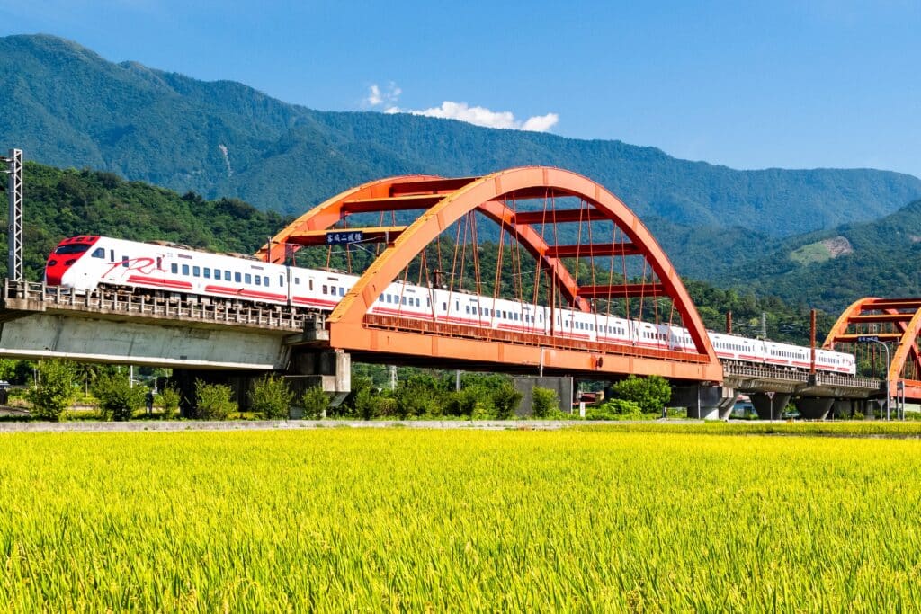
Taiwan is an island located off the southeastern coast of mainland China in the western Pacific Ocean. Though relatively small in area, Taiwan contains some of East Asia’s most dramatic and varied geography — steep mountains, deep gorges, fertile plains, and rugged coastlines shaped by powerful tectonic forces.
The island sits along the boundary between the Eurasian Plate and the Philippine Sea Plate. Ongoing plate collision and subduction have uplifted the Central Mountain Range, which runs north to south and includes peaks exceeding 3,000 meters. These mountains dominate the island’s interior and are among the highest in East Asia outside the Himalayas.
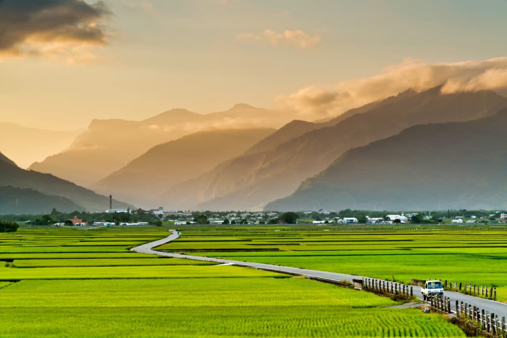
Eastern Taiwan is characterized by steep cliffs and narrow coastal plains where mountains descend sharply into the Pacific. In contrast, the western side features broader alluvial plains formed by sediment carried from upland rivers. These lowlands support most of Taiwan’s population and agriculture.
Taiwan’s rivers are generally short and fast-flowing due to the island’s steep terrain. Heavy rainfall, especially during the summer monsoon and typhoon season, contributes to rapid erosion and sediment transport.
The climate ranges from subtropical in the north to tropical in the south. Seasonal monsoons bring distinct wet and dry periods, while typhoons frequently affect the island between summer and early autumn.
Geologically dynamic, climatically intense, and topographically steep, Taiwan is a landscape in motion — continuously shaped by tectonic uplift, rainfall, and ocean forces.
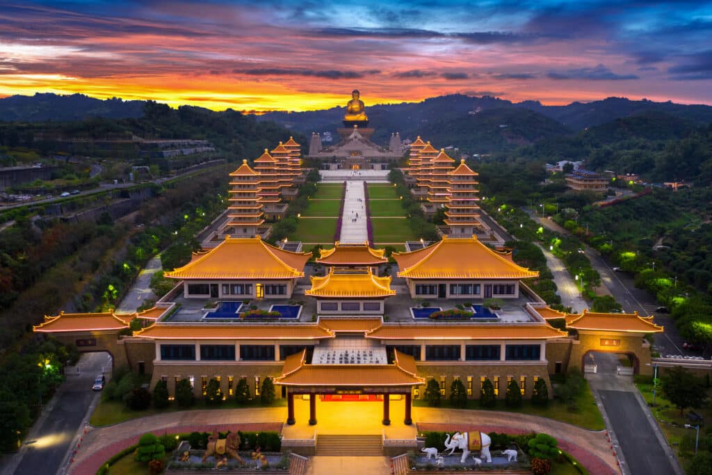
15. Taipei
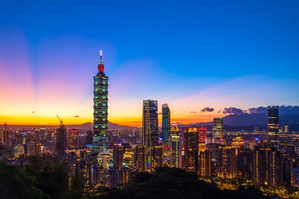
Taipei lies in northern Taiwan within the Taipei Basin, surrounded by low mountains and volcanic hills. Geography here is enclosed river basin shaped by tectonic subsidence and fluvial deposition.
The basin formed along fault lines where crustal movement created a depression later filled with river sediments. The Tamsui River and its tributaries drain the area, carrying runoff from surrounding mountains to the Taiwan Strait.

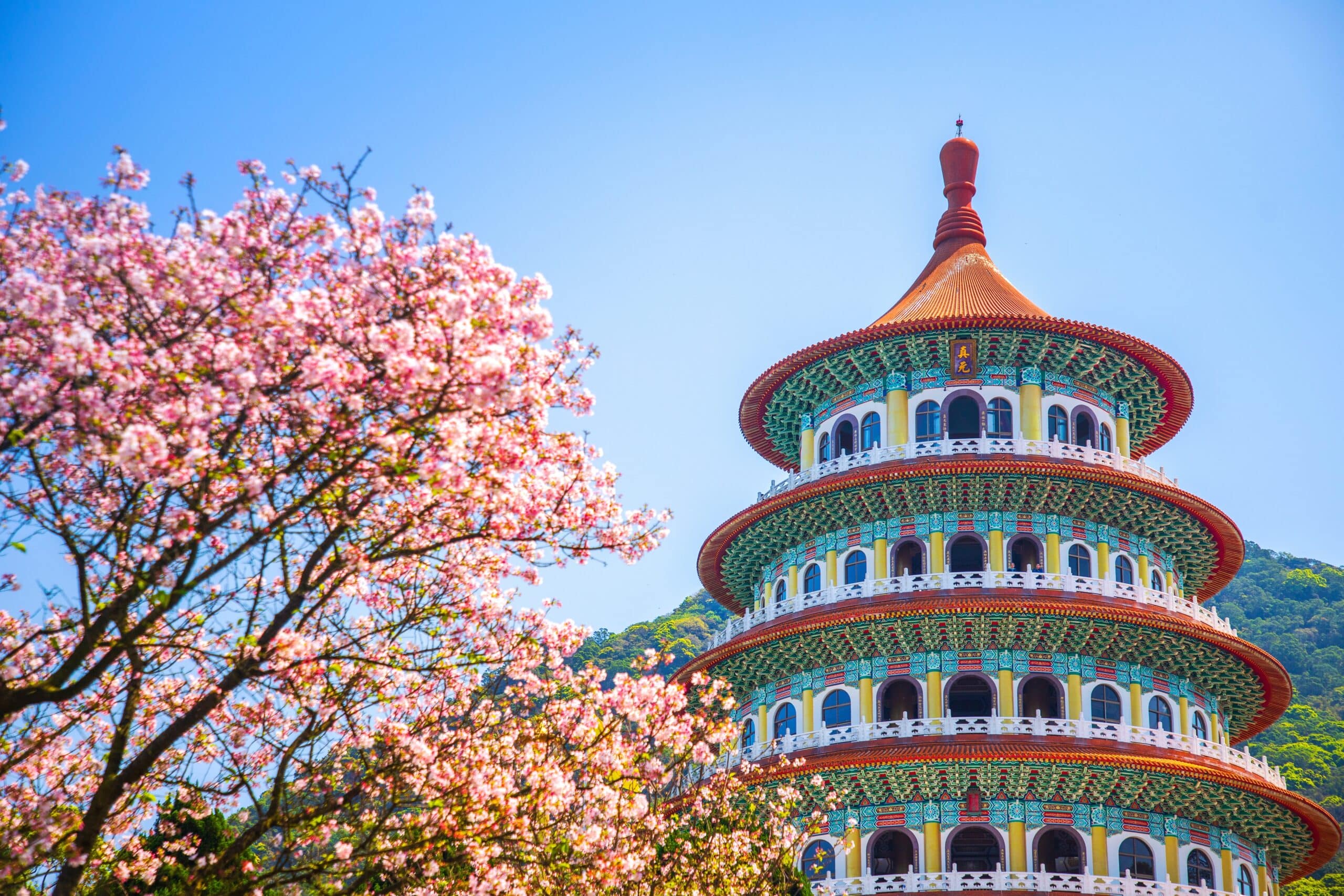
Nearby volcanic features, including the Tatun Volcano Group, indicate past tectonic and magmatic activity. Though dormant, geothermal systems remain active in surrounding uplands.
The climate is humid subtropical, with hot, wet summers influenced by the East Asian monsoon and frequent typhoons. Winters are mild and damp.
Geologically, Taipei sits at the convergence of tectonic plates that continue to uplift central Taiwan while creating localized subsidence in basins. Earthquakes are relatively common due to this ongoing plate interaction.

Endurance here is tectonic and hydrological. Flood control, seismic preparedness, and slope stabilization are essential in this densely populated basin.
Taipei reflects northern Taiwan’s basin-and-volcanic geography — river-filled, fault-shaped, and monsoon-driven. Visitors encounter mountain-framed skylines and active river systems that demonstrate the island’s dynamic geological setting.
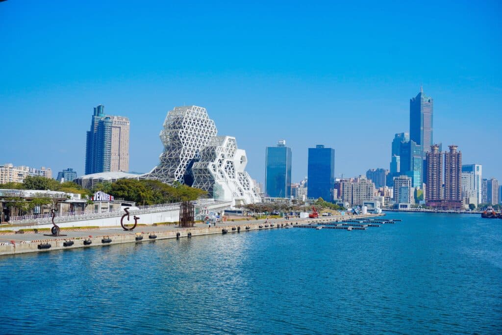
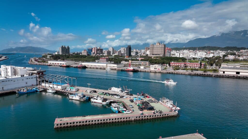
14. Kaohsiung

Kaohsiung is located in southern Taiwan along the Taiwan Strait. Geography here is coastal plain backed by low hills and mountains.
The city occupies part of the southwestern alluvial plain formed by rivers descending from Taiwan’s Central Mountain Range. Sediments deposited over thousands of years created flat, fertile terrain.

The Love River flows through the city before reaching the sea, illustrating the short, steep drainage patterns typical of Taiwan’s rivers.
The climate is tropical, with hot summers and a pronounced monsoon season. Typhoons frequently affect the region during late summer and early autumn.
Geologically, Kaohsiung rests on sedimentary deposits derived from rapid mountain erosion. Offshore coral formations and coastal wetlands characterize portions of the shoreline.
Endurance here is coastal and climatic. Storm surge protection and river management are critical in this low-elevation region.
Kaohsiung reflects southern Taiwan’s coastal plain geography — river-built, sea-facing, and monsoon-shaped. Visitors encounter broad harbors and flat horizons framed by distant hills shaped by tectonic uplift.
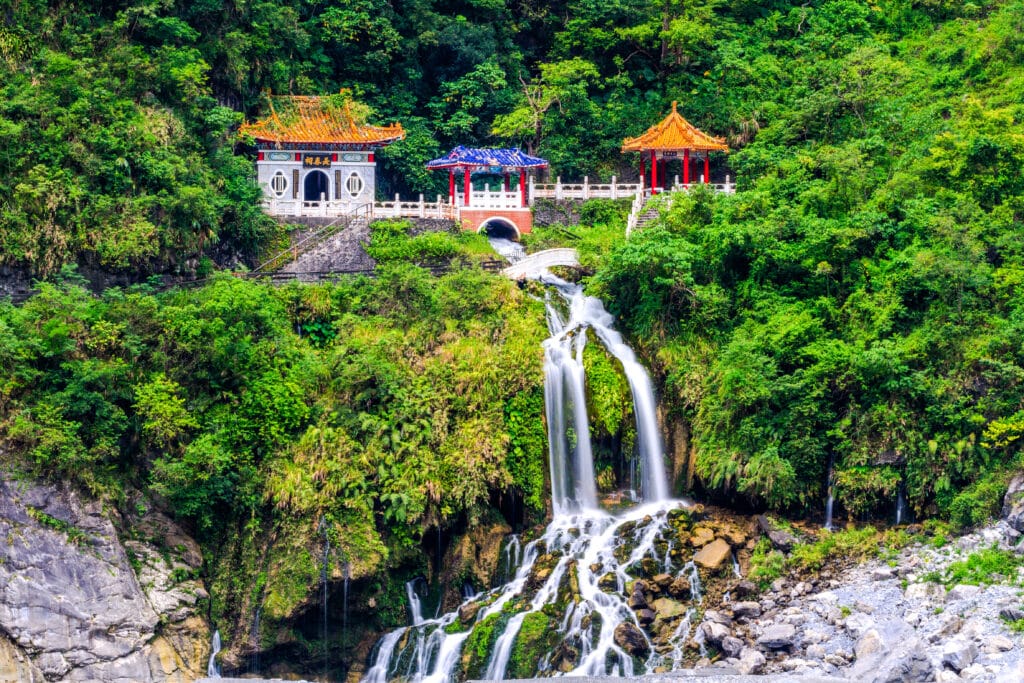
13. Taroko Gorge

Taroko Gorge is located on Taiwan’s eastern side within Taroko National Park. Geography here is dramatic marble canyon carved through steep mountain terrain.
The gorge was formed by the Liwu River cutting through uplifted metamorphic rock. Over millions of years, tectonic uplift raised central Taiwan while river erosion sliced deep, narrow valleys.
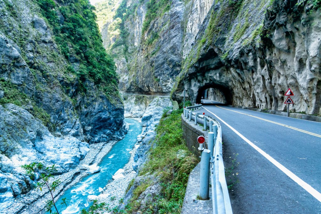
The Central Mountain Range rises sharply around the gorge, with peaks exceeding 3,000 meters. Slopes are steep and prone to landslides, especially after heavy rainfall.
The climate is humid subtropical at lower elevations, becoming cooler and cloudier higher in the mountains. Typhoons can bring intense rainfall that accelerates erosion.
Geologically, Taroko consists largely of marble and schist formed from ancient sedimentary rock subjected to heat and pressure during plate collision.
Endurance here is tectonic and erosional. Ongoing uplift and rainfall continue reshaping the gorge, requiring careful slope monitoring and hazard mitigation.
Taroko Gorge reflects eastern Taiwan’s mountain geography — uplifted, river-carved, and geologically active. Visitors encounter towering cliffs and rushing water that illustrate the powerful interaction between tectonics and erosion.
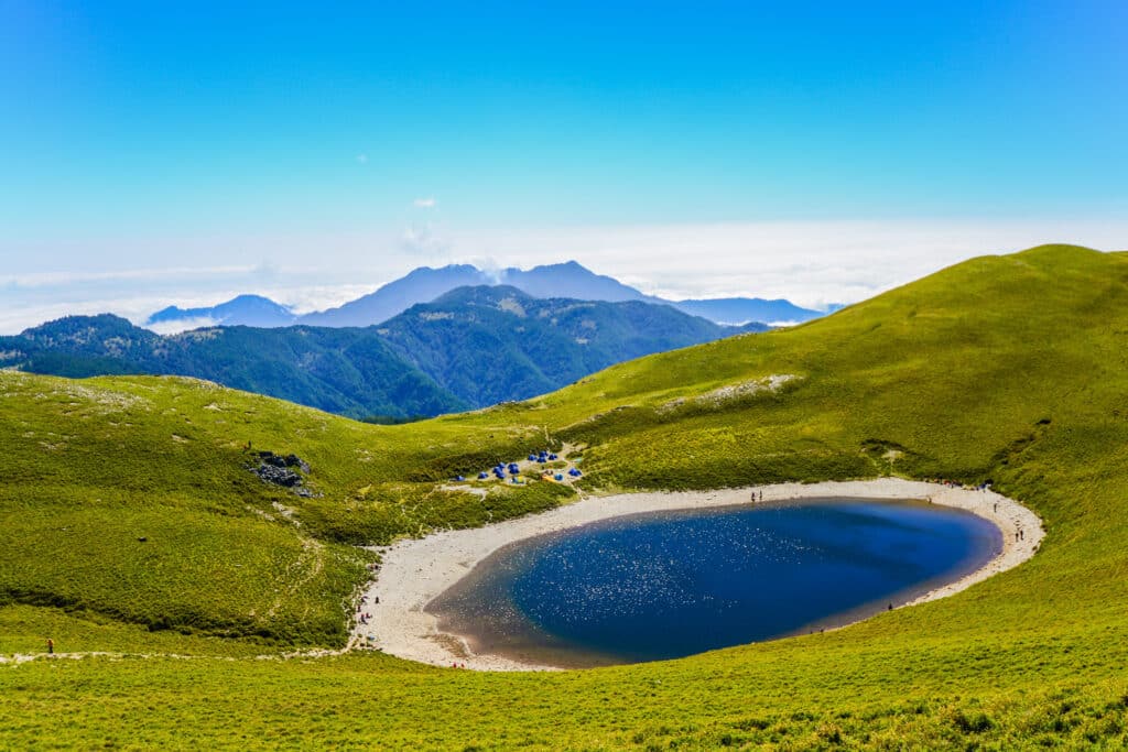
12. Sun Moon Lake
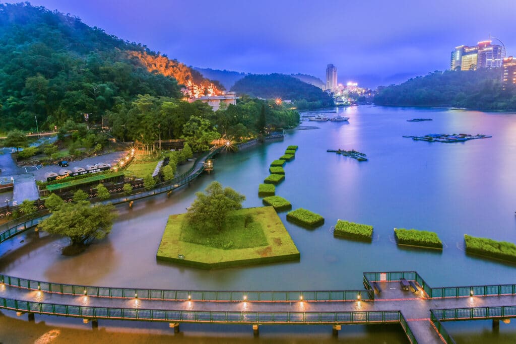
Sun Moon Lake lies in central Taiwan within the foothills of the Central Mountain Range. Geography here is highland freshwater lake formed in a tectonic depression and later modified by natural sedimentation.
The lake sits at approximately 760 meters above sea level and is surrounded by forested hills composed largely of sedimentary and metamorphic rock uplifted by plate collision. Its name derives from the lake’s distinct shape, with one side resembling the sun and the other a crescent moon.

The surrounding watershed is fed by mountain rainfall and small tributary streams. The region experiences a humid subtropical climate, with abundant monsoon precipitation in summer and cooler, misty winters.
Geologically, the basin formed along fault structures created by ongoing interaction between the Eurasian and Philippine Sea plates. The lake’s water levels are influenced both by natural rainfall and managed flow systems.
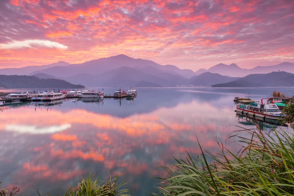
Endurance here is hydrological and tectonic. Careful water management helps maintain ecological balance while supporting regional needs.
Sun Moon Lake reflects central Taiwan’s upland basin geography — tectonically formed, rain-fed, and mountain-framed. Visitors encounter calm waters surrounded by steep green slopes that illustrate the relationship between uplifted terrain and enclosed freshwater systems.
11. Tainan
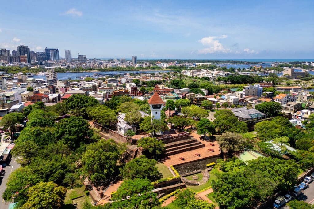
Tainan is located on Taiwan’s southwestern coastal plain along the Taiwan Strait. Geography here is flat alluvial lowland built from sediments transported by short, fast-flowing rivers descending from the Central Mountain Range.

Over thousands of years, rivers deposited sand, silt, and clay across the western shoreline, gradually extending land outward into the sea. Coastal lagoons, wetlands, and tidal flats characterize parts of the region.

The climate is tropical monsoon, with hot summers and concentrated rainfall during typhoon season. Winters are warm and comparatively dry.
Geologically, Tainan rests on thick sedimentary layers formed from continuous erosion of Taiwan’s rapidly rising mountains. Land subsidence and shoreline change remain ongoing concerns in this low-elevation coastal zone.
Endurance here is coastal and fluvial. Flood prevention, wetland conservation, and shoreline stabilization are essential for sustainable development.
Tainan reflects western Taiwan’s sediment-built geography — river-fed, sea-facing, and monsoon-driven. Visitors encounter expansive plains and tidal landscapes that demonstrate how mountain erosion shapes the island’s coastal margins.
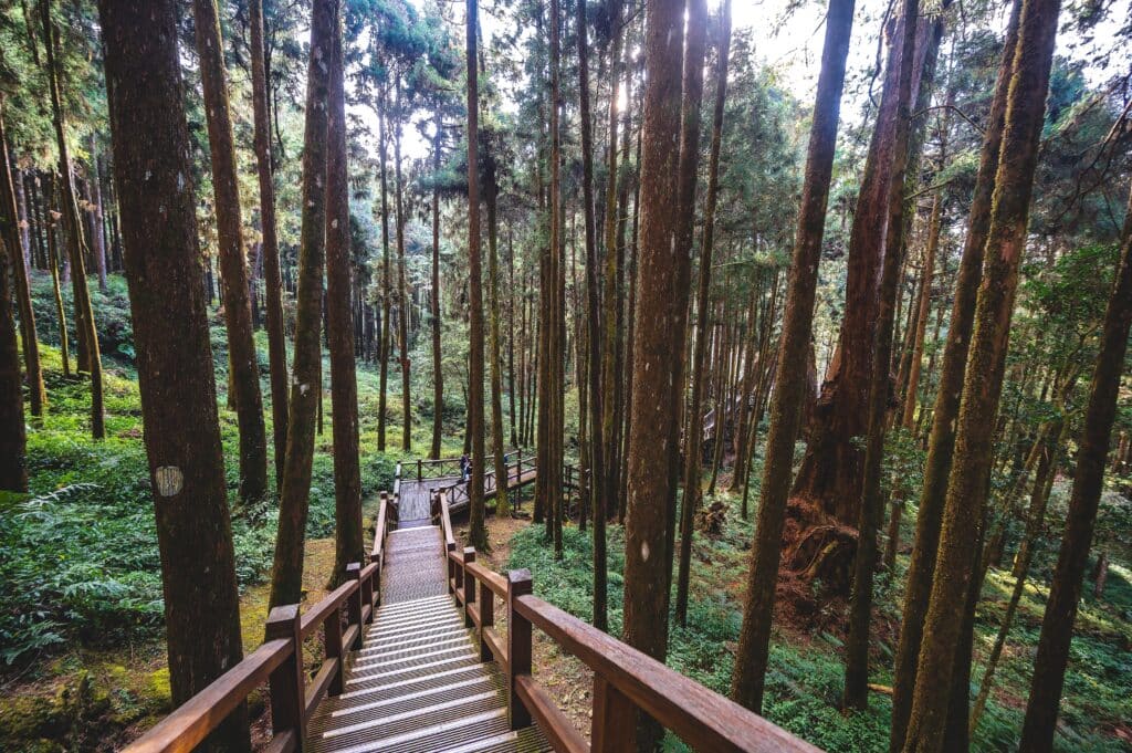
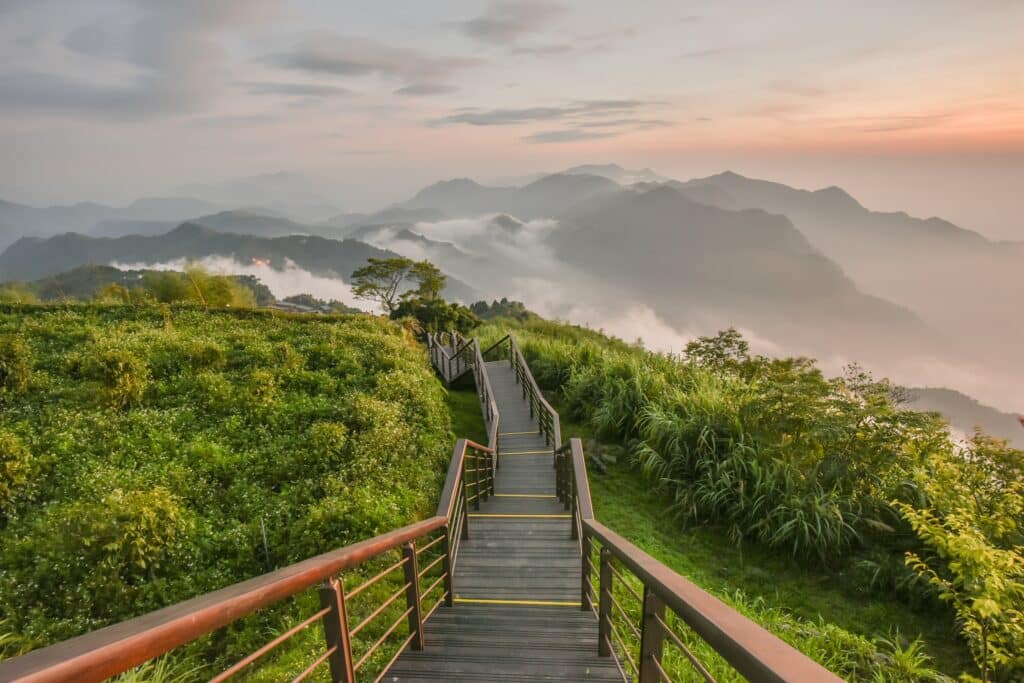
10. Alishan
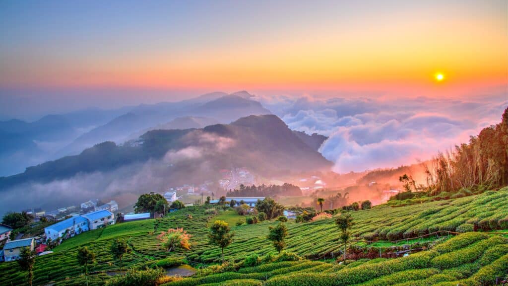
Alishan is located in central-southern Taiwan within the Alishan Mountain Range. Geography here is high-altitude forested mountain terrain shaped by tectonic uplift and intense rainfall.
The range rises above 2,000 meters, with steep slopes composed of sedimentary rock uplifted by plate collision. Deep valleys and ridges form as rivers carve through elevated terrain.
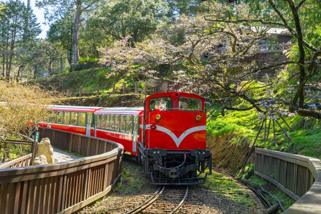
The climate varies with elevation, ranging from subtropical at lower slopes to cool temperate conditions higher up. Frequent mist and cloud cover occur as moist monsoon air rises and condenses along mountain slopes.
Geologically, Alishan consists primarily of sandstone and shale layers tilted by tectonic forces. Earthquakes are common due to Taiwan’s active fault systems.
Vegetation includes dense cedar and cypress forests adapted to cooler highland conditions.
Endurance here is tectonic and climatic. Slope stability and forest conservation are crucial in this erosion-prone mountain environment.
Alishan reflects Taiwan’s central mountain geography — uplifted, forested, and cloud-wrapped. Visitors encounter sweeping vistas above sea-level mist that illustrate the island’s dramatic vertical landscape shaped by plate collision.
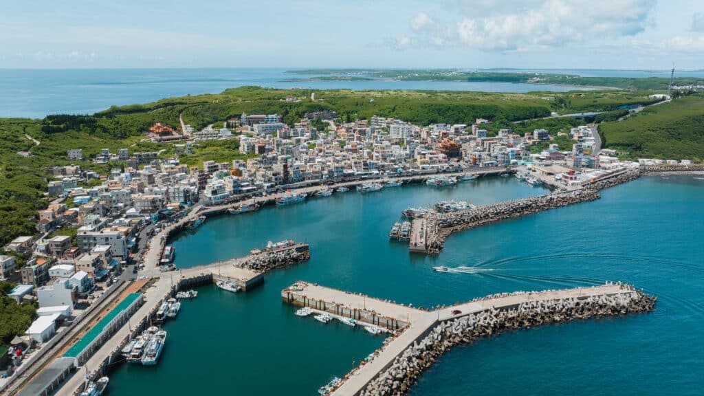
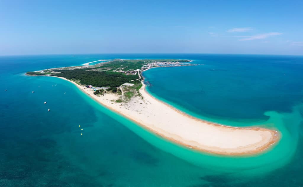
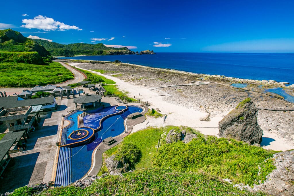
9. Taitung
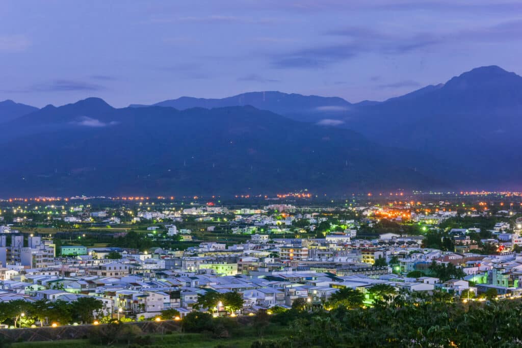
Taitung lies on Taiwan’s southeastern coast between the Central Mountain Range and the Pacific Ocean. Geography here is narrow coastal plain backed by steep, tectonically uplifted mountains.

The city occupies part of the East Rift Valley, a long depression formed along a major fault zone between the Eurasian Plate and the Philippine Sea Plate. This rift structure separates the Central Mountain Range from the Coastal Mountain Range.

Rivers descending from high elevations deposit sediment across the valley floor before reaching the Pacific. The coastline includes sandy beaches, rocky headlands, and uplifted marine terraces.
The climate is tropical to subtropical, with heavy rainfall during monsoon and typhoon seasons. Strong Pacific weather systems frequently influence the area.
Geologically, the region is highly active. Ongoing plate convergence causes uplift, earthquakes, and rapid landscape change.
Endurance here is tectonic and coastal. Earthquake preparedness and storm resilience are central to settlement in this dynamic environment.
Taitung reflects eastern Taiwan’s rift-valley geography — fault-shaped, ocean-facing, and rapidly evolving. Visitors encounter dramatic mountain-to-sea transitions that highlight the island’s active tectonic setting.
8. Penghu (Pescadores Islands)
Penghu is an archipelago located in the Taiwan Strait between mainland Taiwan and mainland China. Geography here is volcanic island terrain shaped by basaltic lava flows and marine erosion.
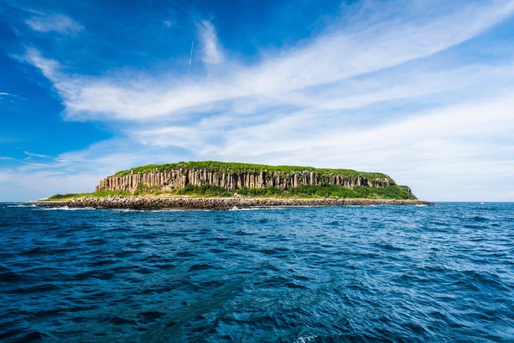
The islands formed from volcanic eruptions millions of years ago when magma rose through oceanic crust. Solidified basalt created flat-topped plateaus and columnar rock formations visible along the coastline.
Wave action has carved cliffs, sea caves, and natural arches into the basalt shoreline. Sandy beaches and tidal flats occur in more sheltered areas.
The climate is subtropical maritime, with strong seasonal winds, especially during the northeast monsoon. Rainfall is moderate compared to Taiwan’s mountainous regions.
Geologically, Penghu consists primarily of basalt, distinct from Taiwan’s uplifted sedimentary mountains. The islands are relatively low in elevation and exposed to persistent wind and wave action.

Endurance here is coastal and climatic. Wind, salt spray, and seasonal storms strongly influence landscape and infrastructure.
Penghu reflects Taiwan Strait island geography — volcanic, wind-swept, and sea-sculpted. Visitors encounter dramatic basalt formations that illustrate the volcanic origins of this offshore archipelago.
7. Yushan (Jade Mountain)

Yushan is the highest peak in Taiwan, rising to 3,952 meters above sea level within Yushan National Park. Geography here is extreme high-mountain terrain formed by plate collision and rapid uplift.

Yushan lies within the Central Mountain Range, created as the Philippine Sea Plate collides with the Eurasian Plate. This ongoing tectonic convergence continues to elevate Taiwan’s interior.
The mountain consists largely of metamorphic rock, including schist and slate, formed under intense pressure during crustal compression. Steep ridges and deep valleys radiate outward from the summit.

The climate shifts dramatically with altitude. Lower slopes are subtropical, while upper elevations experience alpine conditions with occasional snowfall in winter.
Heavy rainfall during monsoon and typhoon seasons accelerates erosion, carving sharp ridgelines and transporting sediment to western plains.
Endurance here is tectonic and climatic. Ongoing uplift, seismic activity, and weather extremes continually reshape the highland landscape.
Yushan reflects Taiwan’s tectonic core — elevated, rugged, and geologically active. Visitors encounter sweeping alpine vistas that demonstrate the powerful forces still shaping the island’s mountainous backbone.
6. Hualien
Hualien lies on Taiwan’s eastern coast between the Pacific Ocean and the Central Mountain Range. Geography here is narrow coastal plain compressed between steep mountains and open ocean.

The city sits along the East Rift Valley system, formed by tectonic movement between the Eurasian Plate and the Philippine Sea Plate. This active fault zone creates frequent seismic activity and ongoing uplift.
Short, fast-flowing rivers descend sharply from the mountains, depositing sediment along the limited coastal plain before reaching the Pacific. Offshore, the ocean floor drops rapidly into deep water.
The climate is humid subtropical, with heavy rainfall during monsoon months and typhoon season. The combination of steep slopes and intense rainfall contributes to landslides and rapid erosion.
Geologically, the surrounding mountains consist largely of metamorphic rock formed under extreme pressure during plate collision. Continuous uplift and erosion define the region’s landscape.
Endurance here is tectonic and coastal. Earthquake resilience and slope stabilization are critical in this seismically active corridor.
Hualien reflects eastern Taiwan’s mountain-to-sea geography — fault-shaped, ocean-facing, and dynamically evolving. Visitors encounter dramatic coastal cliffs and towering peaks that highlight the island’s tectonic intensity.
5. Kenting National Park
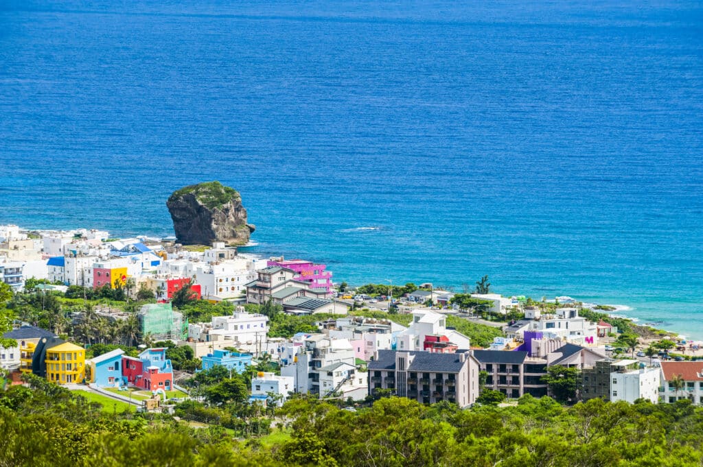
Kenting National Park occupies Taiwan’s southernmost tip along the Bashi Channel. Geography here is tropical peninsula terrain with coral coastlines and uplifted limestone formations.
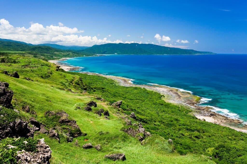
The park includes marine terraces formed by tectonic uplift and coral reefs developed in warm, shallow waters. Wave erosion shapes rocky promontories and sandy beaches.
Inland areas contain limestone hills and grasslands influenced by seasonal winds. The Hengchun Peninsula experiences strong northeast monsoon winds during winter.
The climate is tropical, with warm temperatures year-round and significant rainfall during the summer monsoon and typhoon season.

Geologically, the region reflects both tectonic uplift and coral reef growth. Portions of the coastline display exposed coral limestone that once formed underwater reefs.

Endurance here is coastal and climatic. Coral preservation and storm protection are essential for sustaining fragile marine ecosystems.
Kenting reflects southern Taiwan’s tropical coastal geography — reef-built, wind-shaped, and sea-exposed. Visitors encounter bright coral shores and uplifted limestone landscapes that illustrate the interplay between tectonics and marine growth.
4. Jiufen

Jiufen is a hillside settlement located northeast of Taipei overlooking the Pacific Ocean. Geography here is steep coastal mountain terrain shaped by tectonic uplift and heavy rainfall.

The area sits along Taiwan’s northern mountain belt, where crustal compression has created folded and faulted sedimentary rock layers. Narrow ridges descend sharply toward the sea.
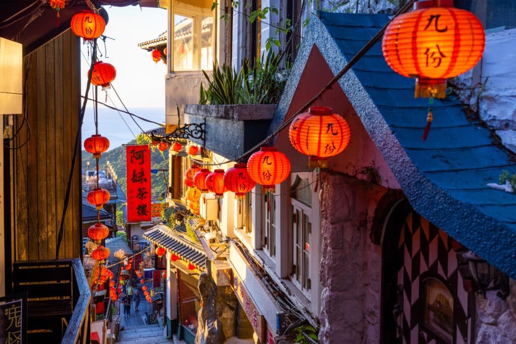
Frequent rainfall and monsoon moisture contribute to lush vegetation and persistent mist. Numerous small streams drain rapidly from the hills into the ocean.
Geologically, the region contains gold-bearing quartz veins formed through hydrothermal processes linked to past volcanic activity. Mining historically shaped local land use.

The climate is humid subtropical, with abundant rainfall throughout much of the year.
Endurance here is erosional and climatic. Slope stability and drainage management are essential in this rainfall-intensive hillside environment.
Jiufen reflects northern Taiwan’s coastal mountain geography — uplifted, mist-covered, and ocean-facing. Visitors encounter steep slopes and sweeping sea views that demonstrate the island’s dramatic vertical transitions from ridge to shoreline.
3. Beitou
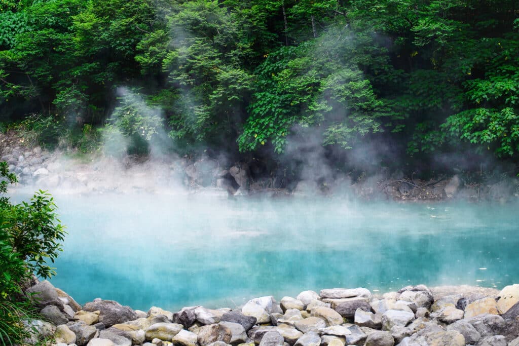
Beitou is a geothermal district located in northern Taipei at the base of the Tatun Volcano Group. Geography here is volcanic foothill terrain shaped by past magmatic activity and ongoing geothermal processes.

The Tatun volcanic system formed through tectonic interaction between the Philippine Sea Plate and the Eurasian Plate. Though considered dormant, fumaroles, sulfur vents, and hot springs remain active.
Beitou’s hot springs originate as groundwater percolates through fractured volcanic rock, where it is heated by residual geothermal energy before resurfacing. Mineral-rich waters deposit sulfur and other compounds along streambeds.

The terrain consists largely of andesite and other volcanic rock types. Steep forested slopes surround narrow valleys carved by runoff from seasonal rainfall.
The climate is humid subtropical, with heavy precipitation during the monsoon season that enhances geothermal surface activity.
Endurance here is geothermal and hydrological. Monitoring volcanic and seismic activity remains essential in this tectonically dynamic region.
Beitou reflects northern Taiwan’s volcanic geography — heat-driven, mineral-rich, and mountain-framed. Visitors encounter steaming vents and forested slopes that illustrate the island’s continuing geological vitality.
2. Lukang

Lukang lies along Taiwan’s central western coast on the Changhua Plain. Geography here is flat coastal lowland formed by sediment deposition from rivers descending the Central Mountain Range.

Over centuries, rivers transported sand and silt westward, gradually extending the shoreline into the Taiwan Strait. Shallow tidal flats and wetlands characterize parts of the coast.
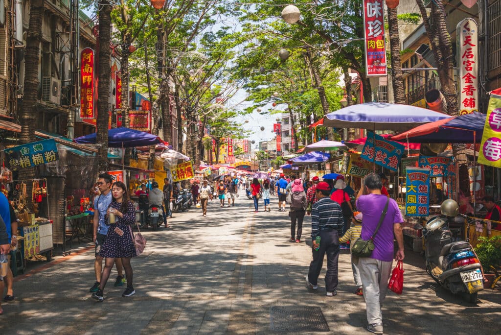
The region’s soils are fertile due to continuous alluvial deposition, supporting agriculture across the plain.
The climate is subtropical monsoon, with hot, humid summers and milder winters. Typhoons periodically affect the coastline.

Geologically, Lukang rests on thick sedimentary deposits derived from rapid mountain erosion. Coastal processes continue to shift shorelines gradually over time.
Endurance here is coastal and fluvial. Flood control and shoreline management are essential in this low-elevation plain.
Lukang reflects western Taiwan’s sediment-built geography — river-fed, flat, and sea-oriented. Visitors encounter expansive plains and tidal environments that demonstrate how erosion in the mountains shapes Taiwan’s western coast.
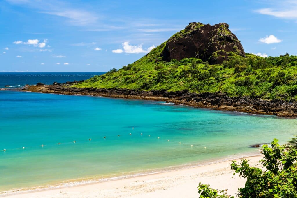
1. Green Island (Lüdao)
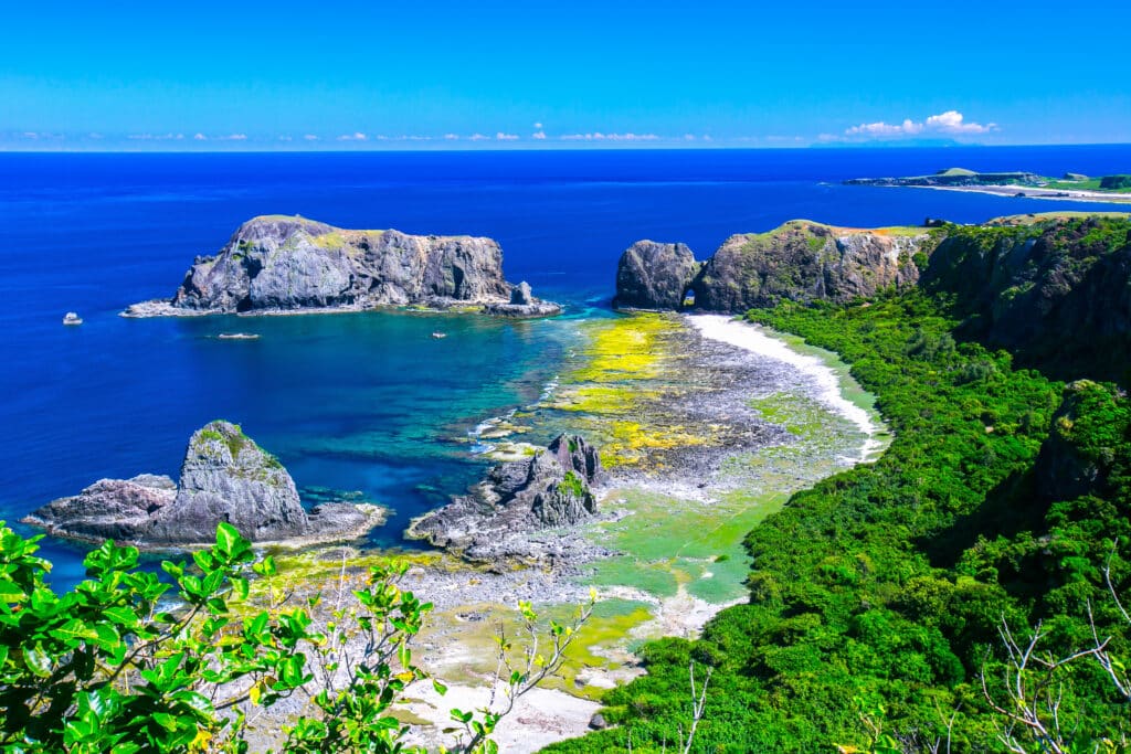
Green Island lies off Taiwan’s southeastern coast in the Pacific Ocean. Geography here is volcanic island terrain rising steeply from the sea.
The island formed from submarine volcanic activity associated with tectonic plate interaction along Taiwan’s eastern boundary. Basaltic and andesitic lava flows created rugged cliffs and rocky headlands.
Wave action has carved sea caves, arches, and coastal terraces along exposed shorelines. Coral reefs have developed in surrounding warm waters.
The climate is tropical maritime, with strong seasonal winds and frequent typhoon influence during summer months.

Geologically, Green Island remains tectonically influenced, though volcanic activity is no longer active. Coastal uplift and marine erosion continue shaping the landscape.
Endurance here is marine and climatic. Coral preservation and storm resilience are central to maintaining ecological balance.
Green Island reflects offshore eastern Taiwan’s volcanic geography — ocean-sculpted, tectonically formed, and reef-fringed. Visitors encounter dramatic basalt cliffs and clear waters that illustrate the island’s volcanic origins rising from the Pacific.