
Rwanda is shaped by elevation. Known as the Land of a Thousand Hills, the country rises and falls in constant motion, its geography never settling into flatness or ease. Hills press close to one another, valleys narrow and deepen, and the land demands attentiveness at every turn. Movement here is deliberate. Geography slows the body and sharpens perception, making presence unavoidable.
The terrain defines climate and character. Elevation cools the air, softens light, and moderates extremes. Rain arrives generously, feeding fertile soils that support intensive agriculture across steep slopes. Terraced hillsides become patterns of effort and endurance, demonstrating how human life has learned to cooperate with land rather than resist it. Geography in Rwanda is not backdrop; it is instructor.
Water moves quietly but persistently through the country. Lakes settle into basins, rivers trace valleys, and wetlands absorb excess rain, regulating life downstream. These systems reinforce balance. Nothing here exists in isolation—each hill drains into another, each field depends on careful management of slope and soil. The land teaches interdependence through form alone.
Rwanda’s destinations are inseparable from this geography. Cities grow vertically rather than outward, villages cluster along ridges, and roads curve endlessly, prioritizing contour over speed. Distance is measured less by kilometers than by ascent and descent. This shapes temperament. Life unfolds with discipline, patience, and awareness of limits imposed by land.
To travel through Rwanda is to engage continually with scale and effort. The land asks for respect, and in return offers clarity. Hills teach perspective. Valleys hold continuity. In Rwanda, geography becomes a quiet guide, shaping a nation that moves forward by understanding the ground beneath its feet.
15. Kigali
Kigali rises across a series of ridges and valleys, its form dictated entirely by Rwanda’s hilly terrain. The city does not sprawl; it climbs. Neighborhoods settle along slopes, and roads curve deliberately, reinforcing a sense of order shaped by geography rather than imposed upon it.
Elevation moderates Kigali’s climate, producing cool mornings and mild afternoons. This steadiness influences pace. Movement is purposeful but not hurried, and the city feels composed rather than compressed. From nearly any point, hills frame the horizon, reminding residents of scale and continuity.
Urban planning here respects terrain. Buildings follow contour lines, drainage systems respond to slope, and green spaces remain integrated into the city’s structure. The land is not erased for development; it guides it. This alignment produces a city that feels balanced, intentional, and grounded.
Kigali inspires through discipline shaped by land. The city’s cleanliness, organization, and calm reflect an understanding that geography demands cooperation. Steep roads discourage excess speed, and elevation encourages awareness. The city teaches that order can emerge naturally when place is respected.
From hilltops, Kigali reveals its coherence—clusters of activity connected by winding routes, framed by greenery and open sky. Geography reinforces perspective, reminding observers that progress here is layered rather than linear. Kigali stands as a capital shaped by restraint and clarity, demonstrating how urban life can thrive by listening closely to the land that holds it.
14. Lake Kivu
Lake Kivu stretches along Rwanda’s western border, settled into a deep rift valley framed by steep hills. Geography here feels expansive yet contained, with water offering openness while land asserts enclosure. The lake’s surface reflects surrounding slopes, amplifying the sense of depth and scale.
The lake moderates climate, cooling nearby towns and softening heat. Fishing communities line the shore, and movement across water complements travel along winding hillside roads. Life aligns with water patterns—wind, wave, and light shape daily routines.
Unlike wide, open lakes, Lake Kivu feels intimate despite its size. Hills descend sharply into water, limiting shoreline and concentrating activity. Settlements adapt carefully, perched above or pressed close to the lake’s edge. Geography demands precision in placement.
Lake Kivu inspires through calm intensity. The water appears still, but depth and geological history remain ever-present. The lake rests within one of the world’s great rift systems, a reminder of forces that shape land slowly but decisively.
The experience here teaches balance. Water offers rest; hills require effort. Movement alternates between ease and exertion, reinforcing awareness of body and environment. Lake Kivu is not merely scenic—it is grounding. It reminds visitors that tranquility can coexist with depth, and that geography often holds both serenity and power in the same frame.
13. Nyungwe Forest
Nyungwe Forest occupies Rwanda’s southwestern highlands, a dense montane rainforest shaped by elevation and rainfall. Geography here closes in. Hills rise steeply, paths narrow, and visibility shortens beneath thick canopy. Movement becomes intentional, guided by sound, slope, and footing.
The forest plays a crucial ecological role. It captures rainfall, feeds rivers, and stabilizes soil across the region. Nyungwe is not isolated wilderness—it is functional landscape, sustaining life far beyond its boundaries. Geography here teaches responsibility through consequence.
Within the forest, time slows. Light filters unevenly, and temperature drops with elevation. Trails follow natural contours, reinforcing the forest’s authority over movement. Human presence feels temporary and careful, shaped by respect rather than dominance.
Nyungwe inspires through continuity. Its ecosystems have persisted across centuries, adapting quietly to change. The forest demonstrates resilience rooted in complexity, where diversity strengthens stability.
Walking through Nyungwe offers a lesson in humility. The land does not accommodate haste. It requires awareness, patience, and acceptance of limitation. Geography becomes teacher, reminding visitors that endurance often depends on restraint. Nyungwe Forest stands as Rwanda’s green reservoir—of water, life, and perspective—quietly sustaining both land and people through disciplined balance.
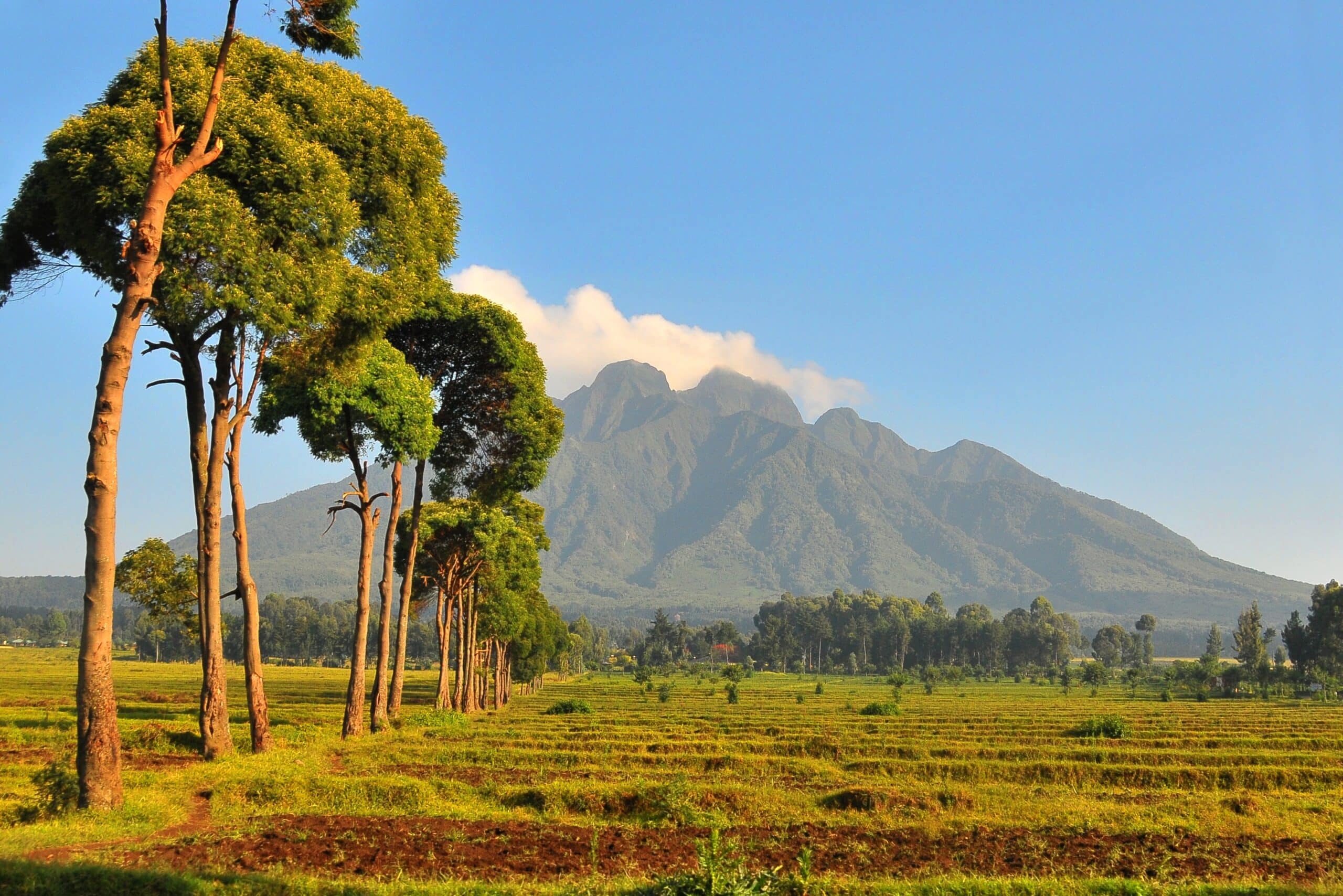
12. Musanze (Volcanoes Region)
Musanze lies beneath the Virunga volcanoes, where Rwanda’s northern landscape rises sharply into dramatic peaks. Geography here is unmistakable. Volcanoes dominate sightlines and consciousness, shaping climate, soil fertility, and movement.
Volcanic soil enriches agriculture, supporting dense farming across surrounding slopes. Fields climb hillsides in careful patterns, reflecting adaptation to steep terrain. Life here is productive but demanding, shaped by elevation and weather.
The volcanoes create a sense of proximity to scale. Clouds gather around peaks, temperatures shift quickly, and the land feels alive with geological memory. Movement through the region is vertical as much as horizontal.
Musanze inspires through coexistence with power. The volcanoes are dormant yet present, reminders of forces beneath the surface. Communities thrive not by ignoring this power, but by adapting to it.
The region teaches respect. Geography imposes limits, but within them offers abundance. Musanze stands as a place where land asserts authority without hostility, shaping resilience through daily negotiation with slope, soil, and altitude. Here, Rwanda’s highland character becomes unmistakable.
11. Huye (Butare)
Huye sits within Rwanda’s southern highlands, shaped by gentler hills and cooler air. Geography here encourages reflection rather than intensity, offering space for learning and continuity.
The town’s elevation moderates climate, creating conditions favorable for settlement and agriculture. Roads curve through hills, reinforcing awareness of distance and terrain. Life unfolds at a measured pace.
Huye inspires through stability. The land does not overwhelm; it supports. Geography provides consistency, allowing institutions and communities to grow with confidence.
The town teaches that intellectual and cultural life benefit from geographic calm. Hills soften urgency, and elevation offers perspective. Huye reflects Rwanda’s quieter highlands—grounded, thoughtful, and enduring.
10. Gisenyi (Rubavu)
Gisenyi rests along the northern shore of Lake Kivu, where water meets volcanic foothills at Rwanda’s western edge. Geography here feels open and breathable, shaped by lake winds and softened by altitude. The shoreline stretches wider than elsewhere along the lake, allowing settlement to expand horizontally rather than cling tightly to slopes.
The lake moderates climate, cooling afternoons and easing evenings. Beaches form naturally, inviting gathering and movement along water rather than uphill. Volcanic soil from nearby mountains supports agriculture inland, blending fertility with stability.
Gisenyi inspires through contrast. The openness of the shoreline balances the enclosing hills common elsewhere in Rwanda. Movement feels lighter here, shaped by water’s horizontality rather than elevation’s insistence.
The town teaches that geography can offer relief without detachment. Lake and land collaborate, creating space for rest while maintaining productivity. Gisenyi reflects Rwanda’s western calm—a place where geography loosens its grip just enough to allow reflection without losing grounding.
9. Rwamagana
Rwamagana lies east of Kigali, where Rwanda’s hills begin to open into broader valleys and gentler slopes. Geography here signals transition—from the densely folded highlands toward the lower, warmer eastern plains.
The land spreads outward, encouraging agriculture on a wider scale. Fields stretch longer, villages disperse slightly, and movement feels less constrained by ascent and descent. The climate warms subtly, altering crops and daily rhythms.
Rwamagana inspires through expansion. The geography offers room—physical and mental—for adjustment. Life adapts to openness without abandoning structure.
The town teaches that geography shapes anticipation. The land prepares travelers for change, easing them gradually into different rhythms. Rwamagana stands as a hinge point, where Rwanda’s intensity softens into breadth without losing coherence.
8. Akagera National Park
Akagera occupies Rwanda’s eastern lowlands, defined by savannah, wetlands, and meandering rivers. Geography here contrasts sharply with the country’s hills, offering openness, horizon, and distance.
The land flattens into plains, interrupted by lakes and papyrus-lined waterways. Wildlife moves freely across space, guided by water availability and seasonal change. The ecosystem depends on balance rather than elevation.
Akagera inspires through rarity. Its openness feels unexpected in Rwanda, revealing the country’s geographic range. The park teaches that national identity is layered, not singular.
Here, geography emphasizes coexistence through space. Land accommodates diversity by allowing separation and movement. Akagera stands as Rwanda’s eastern counterpoint—a reminder that openness can be as defining as enclosure.
7. Nyamata
Nyamata lies south of Kigali in a region where hills widen and wetlands emerge. Geography here is quieter, shaped by fertile lowlands and proximity to water systems that regulate soil and settlement.
The land supports intensive agriculture, and villages align closely with fields. Wetlands absorb seasonal rains, protecting farmland and sustaining productivity. Geography operates subtly but decisively.
Nyamata inspires through grounding. The land encourages rootedness, reinforcing continuity through cultivation. Movement feels local, purposeful, and familiar.
The town teaches that geography sustains memory. The land holds history not through spectacle, but through repeated use and care. Nyamata reflects Rwanda’s capacity for endurance grounded in everyday interaction with terrain.
6. Gicumbi (Byumba)
Gicumbi sits in Rwanda’s northern highlands, where elevation increases and hills sharpen. Geography here reasserts intensity, shaping cooler air and steeper movement.
Farming adapts carefully to slope, with terracing reinforcing cooperation between land and labor. Settlements cluster along ridges, maximizing drainage and access.
Gicumbi inspires through effort. The land demands attentiveness and rewards discipline. Geography here reinforces resilience built through adaptation rather than ease.
The town teaches that elevation shapes mindset. Higher ground encourages awareness of limitation and capacity. Gicumbi stands as a northern echo of Rwanda’s highland character—precise, persistent, and grounded.
5. Kibuye (Karongi)
Kibuye curves along Lake Kivu’s central shoreline, where steep hills descend directly into water. Geography here compresses experience, intensifying both beauty and effort.
Roads cling to slopes, and settlements perch carefully above the lake. Space is negotiated deliberately, with little room for excess. The lake offers relief, but access requires descent.
Kibuye inspires through concentration. Geography reduces distraction, focusing attention on land-water relationships. Life aligns tightly with contour and elevation.
The town teaches that intensity can be sustaining. Constraint sharpens awareness, and beauty emerges from precision. Kibuye reflects Rwanda’s western depth—steep, reflective, and exacting.
4. Bugesera
Bugesera lies in southeastern Rwanda, where hills lower and wetlands widen. Geography here introduces warmth and openness distinct from central highlands.
The land supports agriculture adapted to flatter terrain, and lakes punctuate the landscape, moderating climate. Settlements spread, and movement feels less vertical.
Bugesera inspires through adaptation to subtlety. Geography shifts gently, but consequences are significant. The region teaches attentiveness to gradual change.
Bugesera demonstrates how Rwanda’s identity extends beyond hills alone. The land expands, offering alternative rhythms grounded in water and space rather than slope.
3. Rusizi
Rusizi rests at Rwanda’s southwestern edge, where river valleys open toward Lake Tanganyika’s basin. Geography here feels outward-facing, shaped by low elevation and cross-border waterways.
The Rusizi River defines movement and agriculture, supporting fertile floodplains. Climate is warmer, vegetation denser, and life aligns with river cycles.
Rusizi inspires through connectivity. Geography reinforces exchange rather than enclosure. The land invites movement across boundaries, ecological and human.
The town teaches that geography can orient identity outward without dilution. Rusizi stands as Rwanda’s southwestern threshold—open, fertile, and quietly expansive.
2. Kirehe
Kirehe lies in Rwanda’s eastern interior, defined by rolling low hills and warmer climate. Geography here encourages agricultural breadth rather than intensity.
Fields extend widely, settlements disperse, and life unfolds with less compression. The land rewards planning and foresight, shaped by rainfall patterns rather than elevation.
Kirehe inspires through patience. The geography demands long-term thinking rather than immediate response. Stability emerges from consistency.
The region teaches that endurance takes different forms. In Kirehe, resilience is horizontal rather than vertical—built across space instead of slope.
1. Rutsiro
Rutsiro rises above Lake Kivu’s eastern shore, where hills regain dominance and slopes steepen dramatically. Geography here feels demanding and elevated.
Farming clings to hillsides, and roads wind sharply. The lake remains visible below, reinforcing vertical awareness.
Rutsiro inspires through resolve. The land challenges movement and cultivation, yet sustains life through careful adaptation.
The region teaches respect for limits. Geography insists on precision and effort. Rutsiro concludes Rwanda’s landscape story by reaffirming the country’s defining lesson: that land, when understood and respected, shapes strength through discipline.